 English
 Spanish
 French
 Chinese
 Russian
 Portuguese
 最新宪章启动
Charter activations
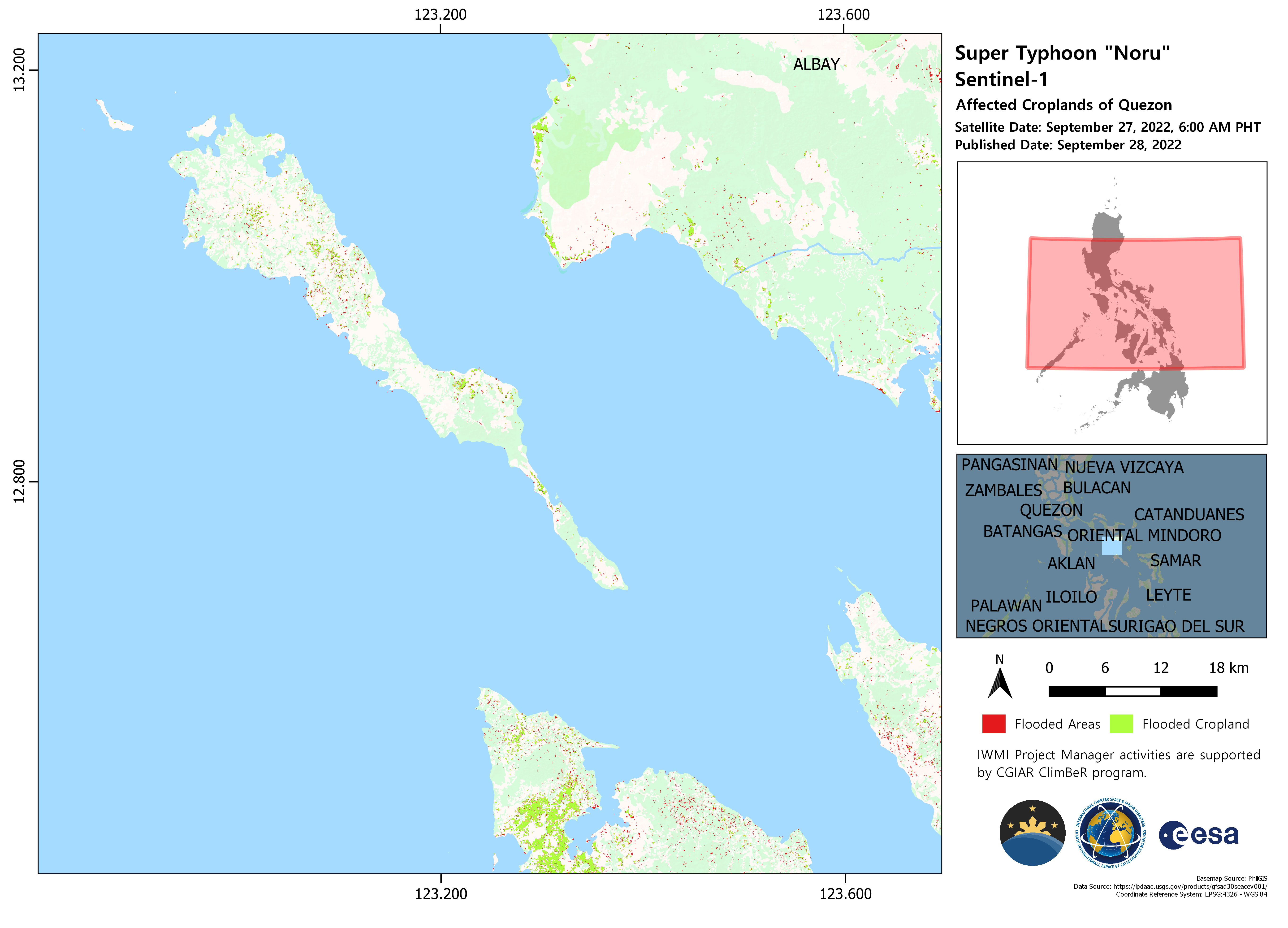
Typhoon Noru in the Philippines
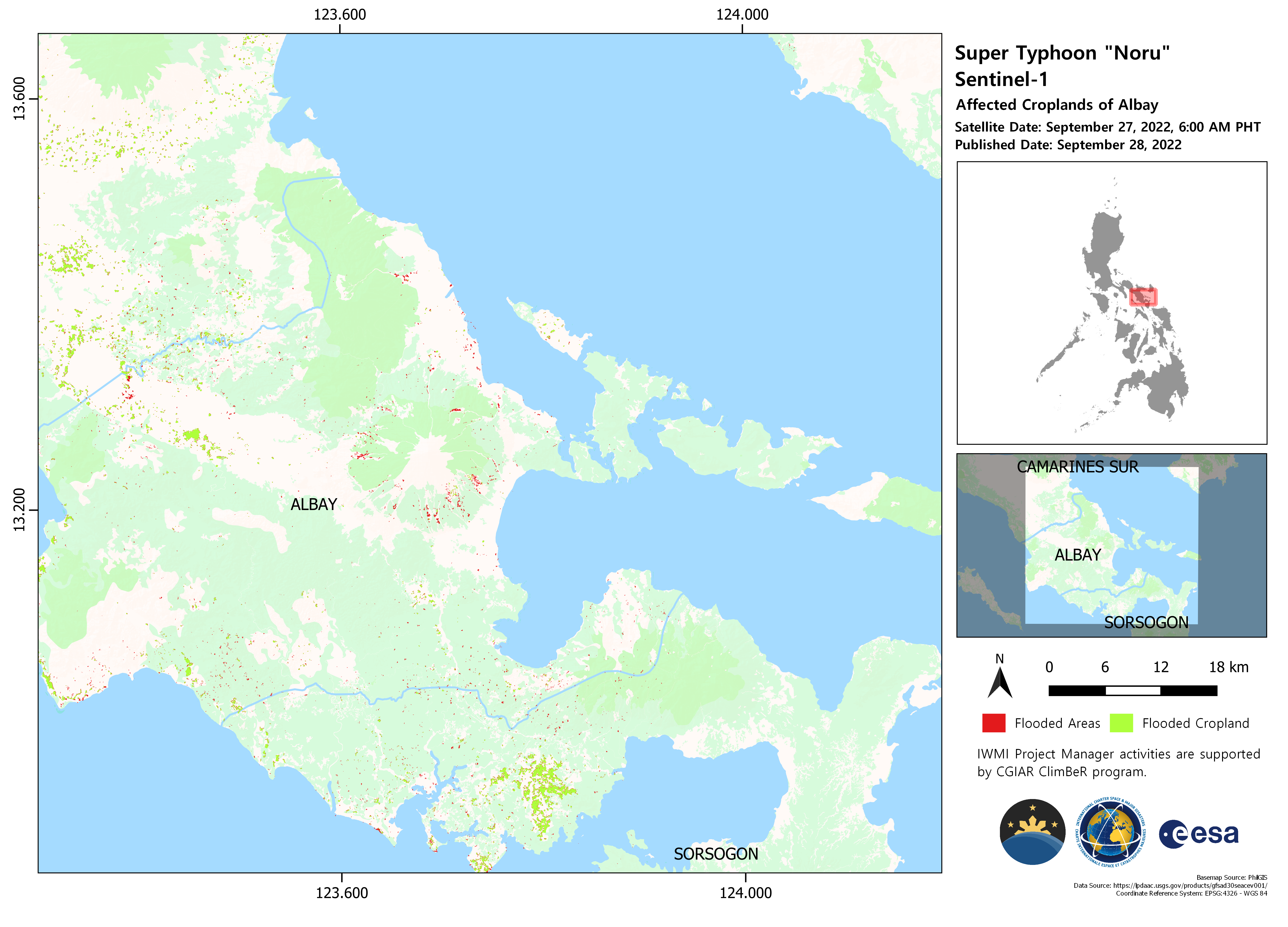
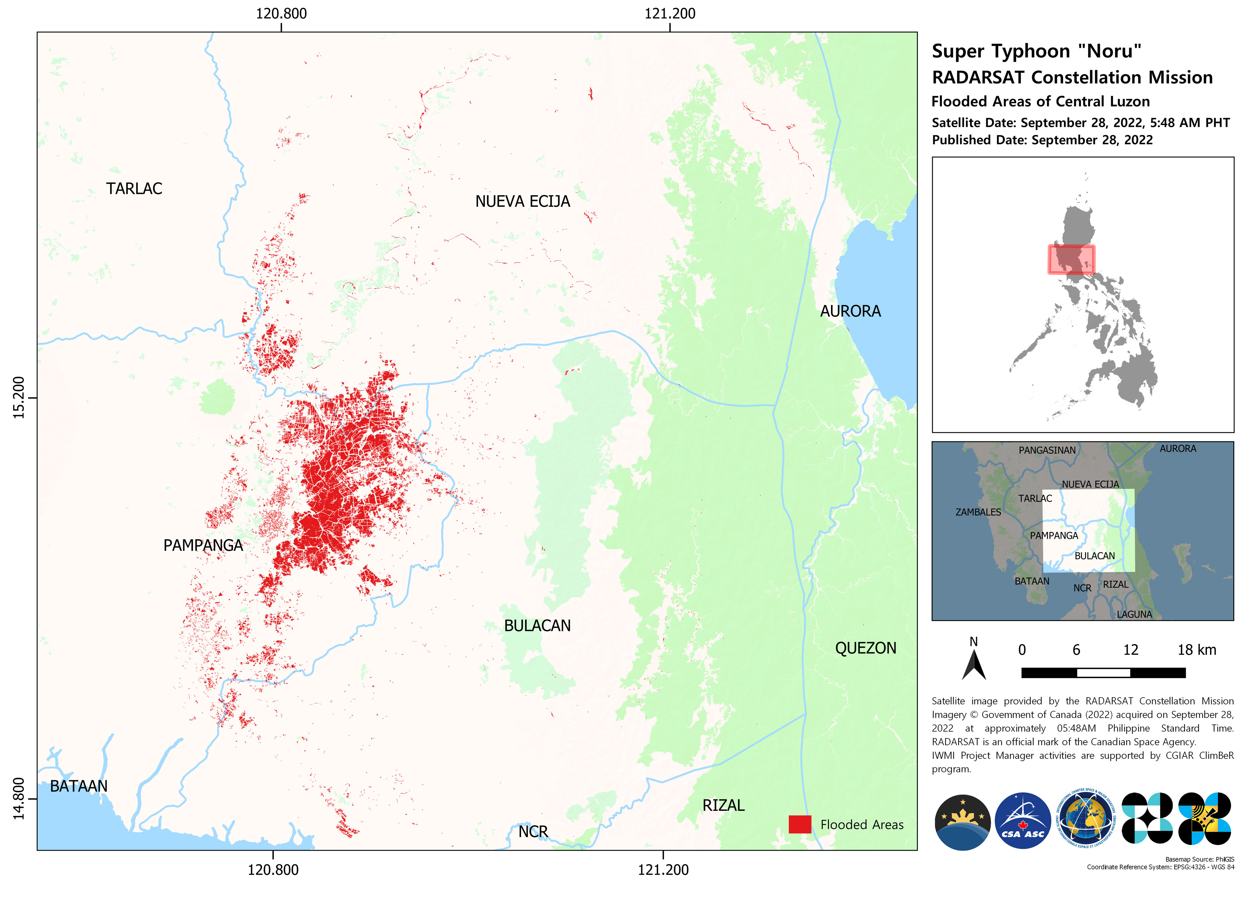
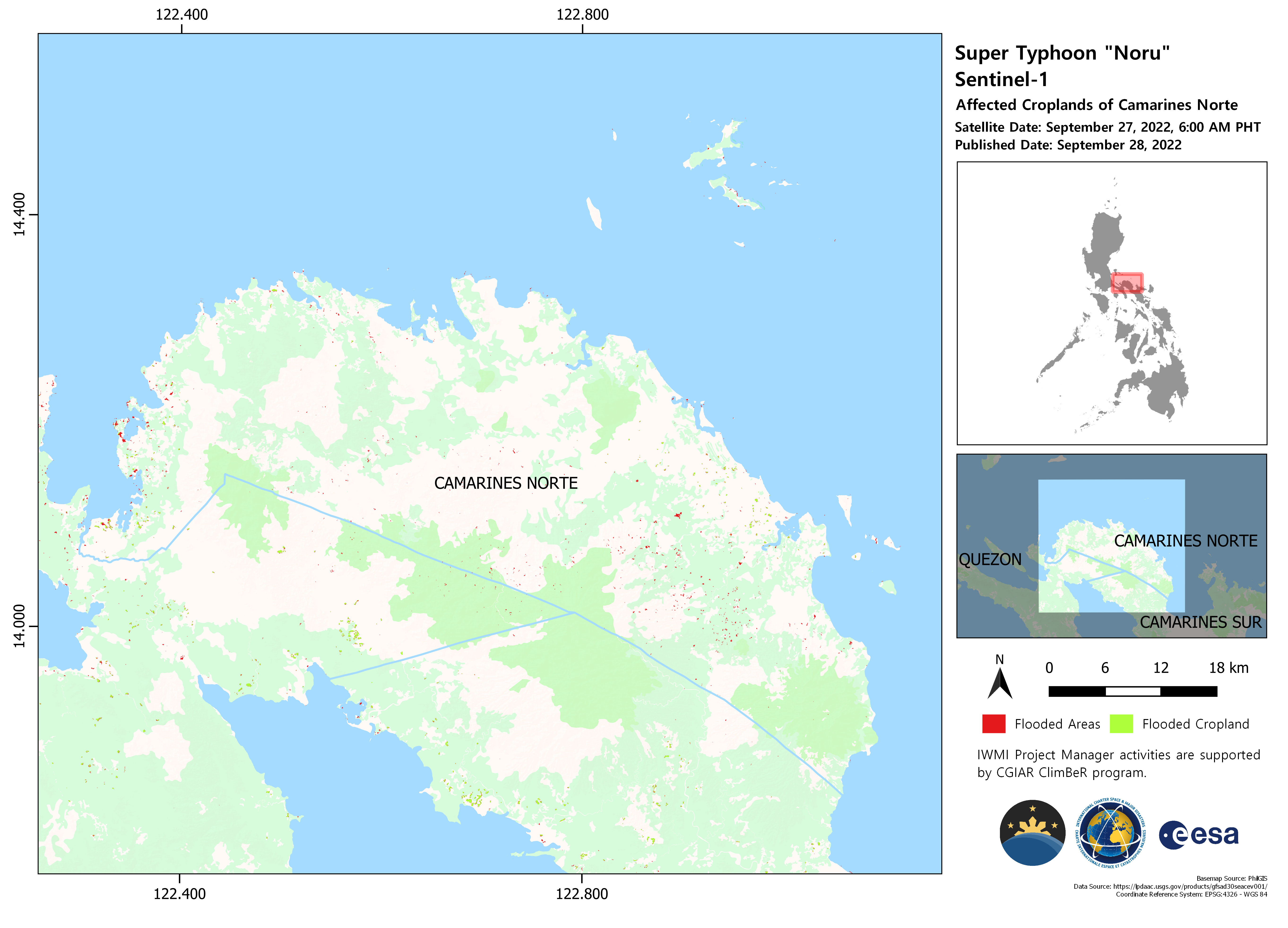
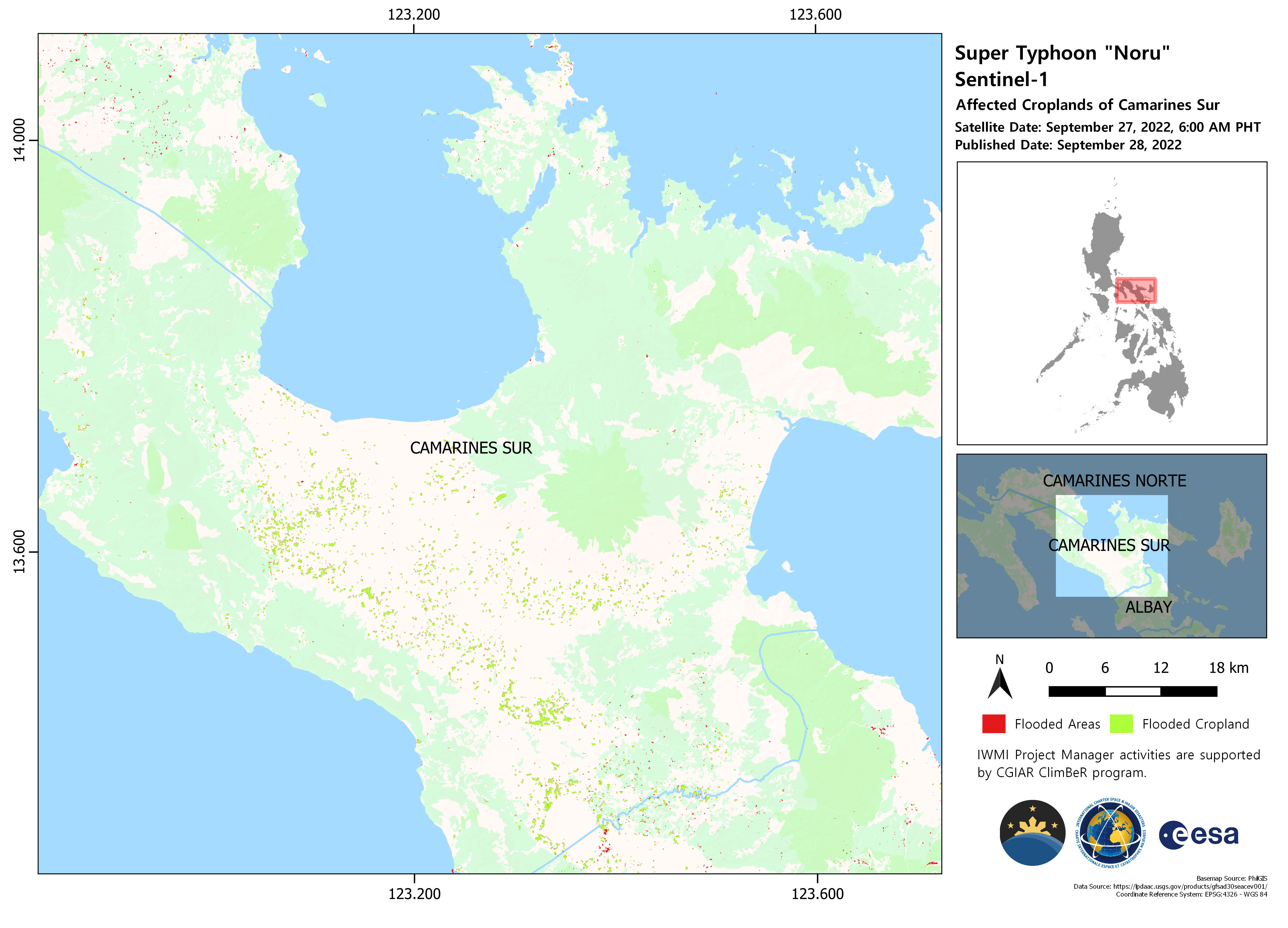
Typhoon Noru made landfall in the Philippines main Luzon island on 25 September 2022, prompting warnings that heavy winds and torrential rain could cause severe flooding. Known locally as Typhoon Karding, the storm intensified rapidly arriving as a super typhoon with maximum sustained winds of 240 kilometers per hour.
The National Disaster Risk Reduction and Management Council reported that the highest emergency response protocol was activated in Metro Manila, Central Luzon, Calabarzon, Mimaropa, and the Bicol region. Five rescue workers in the Philippines were killed and many homes flooded leaving millions without electricity. President Marcos ordered that supplies be airlifted and clean-up equipment provided to communities that were most affected.
Related News and Resources
| 事件地点: | Philippines |
| 启动宪章的日期: | 2022-09-25 |
| 宪章启动时间: | 17:48 |
| 宪章启动时区: | UTC+08:00 |
| 宪章要求者: | UNOOSA/UN-SPIDER on behalf of Philippines Space Agency on behalf of the National Disaster Risk Reduction and Management Council, Office of Civil Defense ADRC on behalf of AHA Center |
| 启动ID: | 782 |
| 项目经理: | Giriraj Amarnath (International Water Management Institute) |
| act-value-adders: | Shielo Muta (Philippines Space Agency) |
Products
 返回完整的响应档案

