 English
 Spanish
 French
 Chinese
 Russian
 Portuguese
 Flood in Nepal
Flood in Nepal
Charter activations
Flood in Nepal
Monsoon rains have caused floods and landslides in the central and eastern districts of Nepal.
The region has been impacted since the start of monsoon season in June, but it is expect the peak of the rains will be between 10 and 14 July.
It is estimated that almost 60 people have died during due to disasters caused by the monsoon rains, so far.
On 9 July, landslides impacted settlements on the Araniko Highway in Sindhupalchowk district. The landslides were triggered by the rain, and killed two people, with 20 still missing.
Floods at Jambu and Bulkute destroyed 16 houses and two people have been confirmed killed.
Relief and rescue operations are underway, but hampered by the floods and landslides in the area.
| Type of Event: | Floods and landslides |
| Location of Event: | Nepal |
| Date of Charter Activation: | 2020-07-08 |
| Time of Charter Activation: | 21:37 |
| Time zone of Charter Activation: | UTC+02:00 |
| Charter Requestor: | UNITAR on behalf of UN Resident Coordinator's Office - Humanitarian Information Management Unit (HIMUM) |
| Activation ID: | 658 |
| Project Management: | UNITAR |
Products

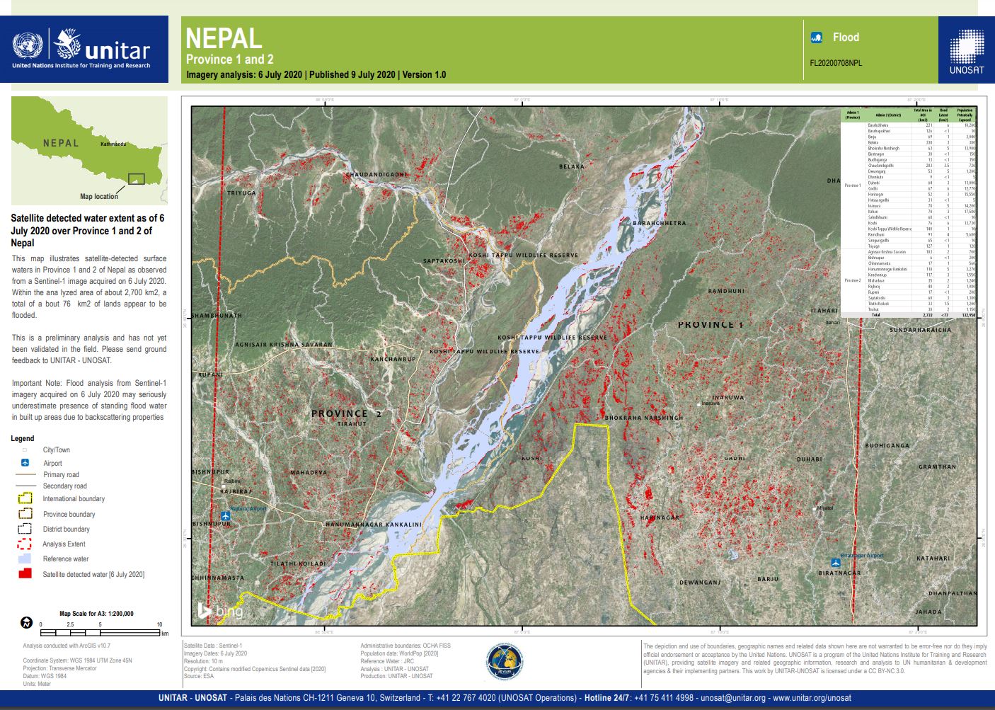
Satellite detected water extent over Province 1 and 2 of Nepal
Copyright: RADARSAT-2 Data and Products © Maxar Technologies Ltd. (2020) – All Rights Reserved. RADARSAT is an official mark of the Canadian Space Agency.
Map produced by UNITAR/UNOSAT
Information about the Product
Acquired: 12/07/2020
Source: RADARSAT-2
 Back to the full activation archive
