 English
 Spanish
 French
 Chinese
 Russian
 Portuguese
 Última Activación
Charter activations
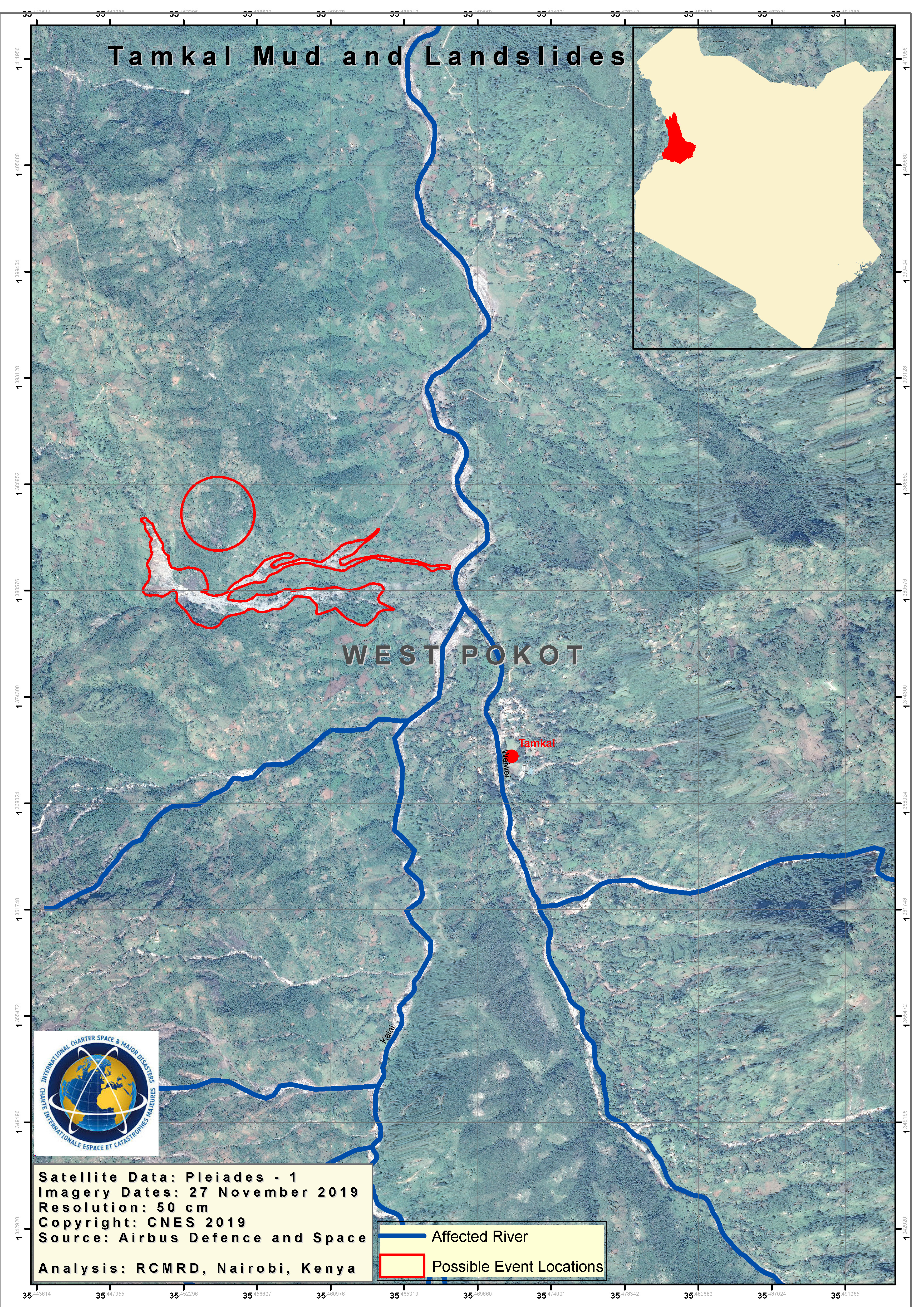
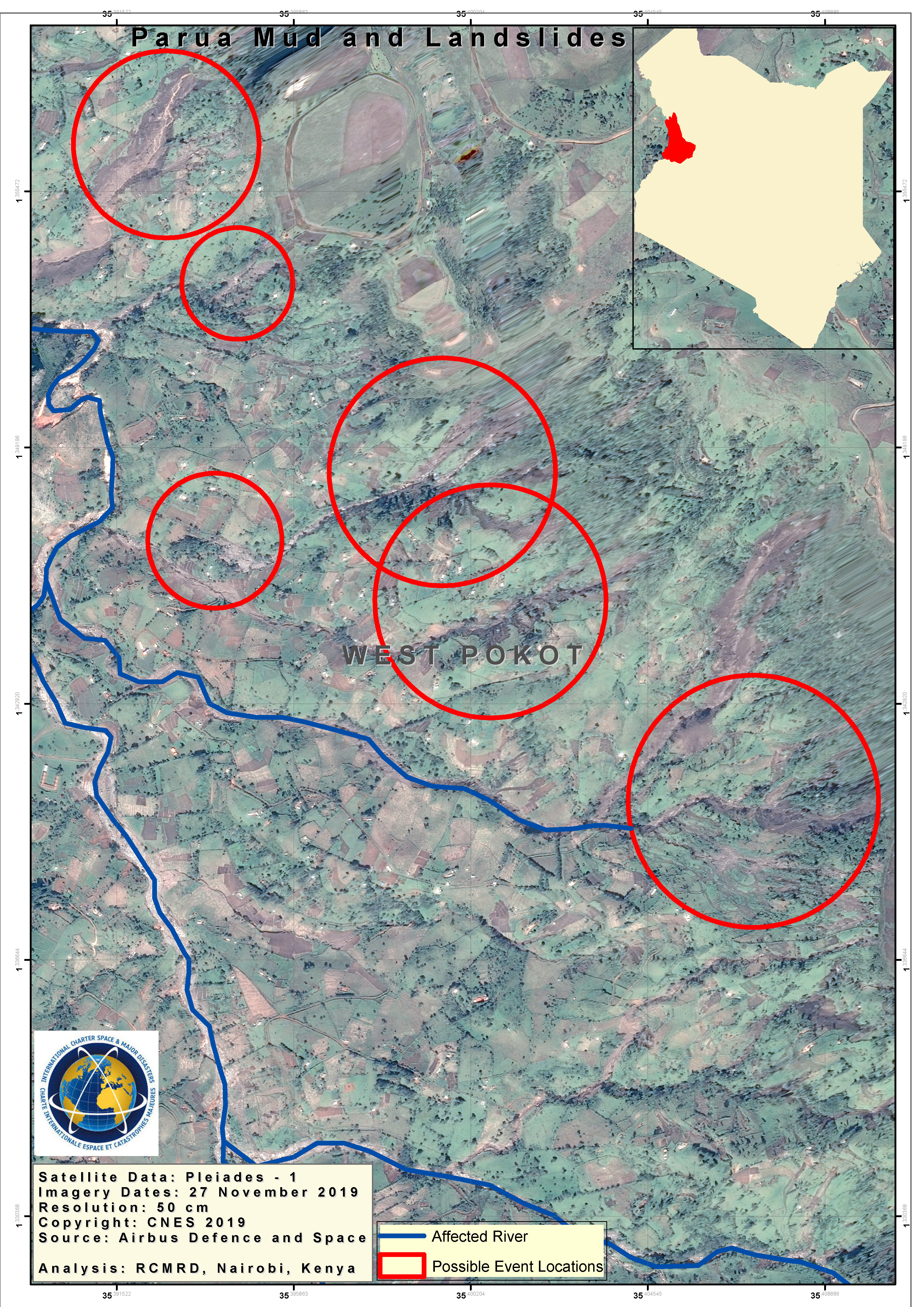
Landslide in Kenya
Heavy rain has caused landslides in the Pokot region, 220 miles north-west of the capital Nairobi. At least 60 people are reported to have been killed.
Kenya's meteorological department issued warnings of heavy rains on 18 November, telling people in areas likely to be affected by landslides to be on "high alert".
The worst affected areas are the villages of Nyarkulian and Parua. Rescue efforts have been hampered because roads have been cut off by flooding and bridges closed after streams began overflowing.
The president of Kenya reported 'massive destruction' of property and infrastructure, and that he has ordered armed forces and rescue services to the area to help the 5,000 families that have been displaced by flash flooding.
Weather forecasts are predicting more rain which is expected to worsen flooding in low-lying areas.
| Type of Event: | Landslide |
| Location of Event: | Kenya |
| Date of Charter Activation: | 2019-11-25 |
| Time of Charter Activation: | 02:37 |
| Time zone of Charter Activation: | UTC+00:00 |
| Charter Requestor: | NADMO on behalf of Kenya Defence Forces |
| Activation ID: | 633 |
| Project Management: | NADMO |
Products

Landslide assessment of West Pokot County, Kenya
Copyright: Pleiades © CNES (2019) - Distribution: Airbus Defence and Space, all rights reserved
WorldView-3 © DigitalGlobe Inc.
Map produced by UNITAR/UNOSAT
Information about the Product
Acquired: Pleiades: 28/11/2019
WorldView-3: 24/11/2018
Source: Pleiades / WorldView-3
 Back to the full activation archive

