Minimizar Última Activación

Charter activations

Flood in Niger

At least 45 people have been killed and more than 225,000 people have been displaced by flooding caused by heavy rainfall in Niger.

Niger's western region has been badly hit after days of torrential rainfall caused the River Niger to burst its banks. The capital city of Niamey was brought to a standstill by the waters.

Local authorities reported almost 30,000 houses being affected with some 868 houses being swept away. A number of mosques and granaries have also been destroyed as well as many rice fields being submerged.

Much of Niger has been affected by rainfall since July, but the recent rainfall and water levels of the River Niger has surpassed previous records.

Type of Event:Floods
Location of Event:Niger
Date of Charter Activation:2020-09-21
Time of Charter Activation:10:46
Time zone of Charter Activation:UTC+02:00
Charter Requestor:UNOOSA/UN-SPIDER on behalf of Direction Générale de la Protection Civile (DGPC) - NIGER
Activation ID:677
Project Management:ICube SERTIT

Products

Flood Change Detection Map of Tenda, Niger as Observed on 9 October 2020

Copyright: © KARI (2020)
Contains modified Copernicus Sentinel data (2020)
Map produced by National Space Research and Development Agency (NASRDA)

Information about the Product

Acquired: Sentinel-1: 27/09/2020
KOMPSAT-3: 27/09/2020

Source: KOMPSAT-3 / Sentinel-1

Flood Extent Map of Tenda, Niger, Observed on 09/10/2020

Copyright: © KARI (2020)
Contains modified Copernicus Sentinel data (2020)
Map produced by National Space Research and Development Agency (NASRDA)

Information about the Product

Acquired: KOMPSAT-3: 27/09/2020
Sentinel-1: 04/10/2020

Source: KOMPSAT-3 / Sentinel-1

Delineation Product with the identification of the affected areas over Dogondoutchi

Copyright: Contains modified Copernicus Sentinel data (2020)
Map produced by GMV

Information about the Product

Acquired: 12/09/2020

Source: Sentinel-2

Flood Change Detection Map of Niamey, Niger as Observed on 07/10/2020

Copyright: Contains modified Copernicus Sentinel data (2020)
© KARI (2020)
Map produced by NASRDA

Information about the Product

Acquired: Sentinel-1: 15/09/2020 and 27/09/2020
KOMPSAT-3: 02/10/2020

Source: Sentinel-1 / KOMPSAT-3

Flood Extent Map of Niamey, Niger as Observed on 02/10/2020

Copyright: © KARI (2020)
Contains modified Copernicus Sentinel data (2020)
Map produced by NASRDA

Information about the Product

Acquired: KOMPSAT-3: 02/10/2020
Sentinel-1: 27/09/2020

Source: KOMPSAT-3 / Sentinel-1

Delineation Product with the identification of flooded areas over Tahoua

Copyright: Contains modified Copernicus Sentinel data (2020)
Map produced by Copernicus EMS

Information about the Product

Acquired: 27/09/2020

Source: Sentinel-2

Delineation Product with the identification of flooded areas and flood traces over Bangi in Niger

Copyright: Contains modified Copernicus Sentinel data (2020)
Map produced by GMV

Information about the Product

Acquired: 27/09/2020

Source: Sentinel-2

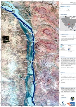
Flood extent and impact over Kollo to Say area, Niger, as observed the 25/09/2020

Copyright: Contains modified Copernicus Sentinel data (2020)
Map produced by SERTIT

Information about the Product

Acquired: 25/09/2020

Source: Sentinel-2

Flood extent and impact over Kirtachi, Niger, as observed on the 25/09/2020

Copyright: Contains modified Copernicus Sentinel data (2020)
Map produced by SERTIT

Information about the Product

Acquired: 25/09/2020

Source: Sentinel-2

NOAA VIIRS 5-day Maximum Flood extent from 23-27 September 2020 over Niamey, Niger

Copyright: NOAA - Suomi NPP/NOAA-20
Map produced by NOAA

Information about the Product

Acquired: 27/09/2020

Source: NOAA

Flood extent and impact over Tillaberi area, Niger, as observed on 23/09/2020

Copyright: Includes Pleiades material © CNES (2020), Distribution Airbus DS.
Map produced by SERTIT

Information about the Product

Acquired: 23/09/2020

Source: Pleiades

Flood extent and impact over Niamey, Niger, as observed on 15/09/2020

Copyright: Contains modified Copernicus Sentinel data (2020)
Map produced by SERTIT

Information about the Product

Acquired: 15/09/2020

Source: Sentinel-2

Flood extent and impact over Tenda area, Niger, observed on the 22/09/2020

Copyright: Includes Pleiades material © CNES (2020), Distribution Airbus DS.
Map produced by SERTIT

Information about the Product

Acquired: 22/09/2020

Source: Pleiades

Suomi NPP and NOAA VIIRS 1-day Maximum Flood extent from 21 September 2020 over Niamey, Niger

Copyright: NOAA-20 and Suomi NPP
Map produced by NOAA

Information about the Product

Acquired: 21/09/2020

Source: NOAA-20, Suomi NPP

Back to the full activation archive