 English
 Spanish
 French
 Chinese
 Russian
 Portuguese
 Última Activación
Charter activations
Tropical Cyclone Eloise in Mozambique
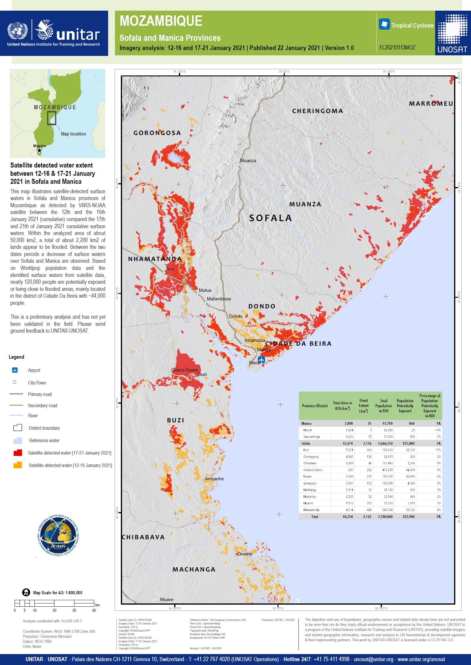
Tropical Cyclone Eloise made landfall in Mozambique on 23 January. Reports indicate that nearly 7,000 people have been displaced and more than 5,000 houses have been destroyed, damaged or flooded, mainly in Buzi, Dondo, Nhamatanda and Beira City.
Related News and Resources
| Type of Event: | Cyclone |
| Location of Event: | Mozambique |
| Date of Charter Activation: | 2021-01-22 |
| Time of Charter Activation: | 14:07 |
| Time zone of Charter Activation: | UTC+01:00 |
| Charter Requestor: | UNITAR on behalf of United Nations Office for the Coordination of Humanitarian Affairs (OCHA) / Regional Office for Southern & Eastern Africa |
| Activation ID: | 696 |
| Project Management: | UNITAR/UNOSAT |
Products
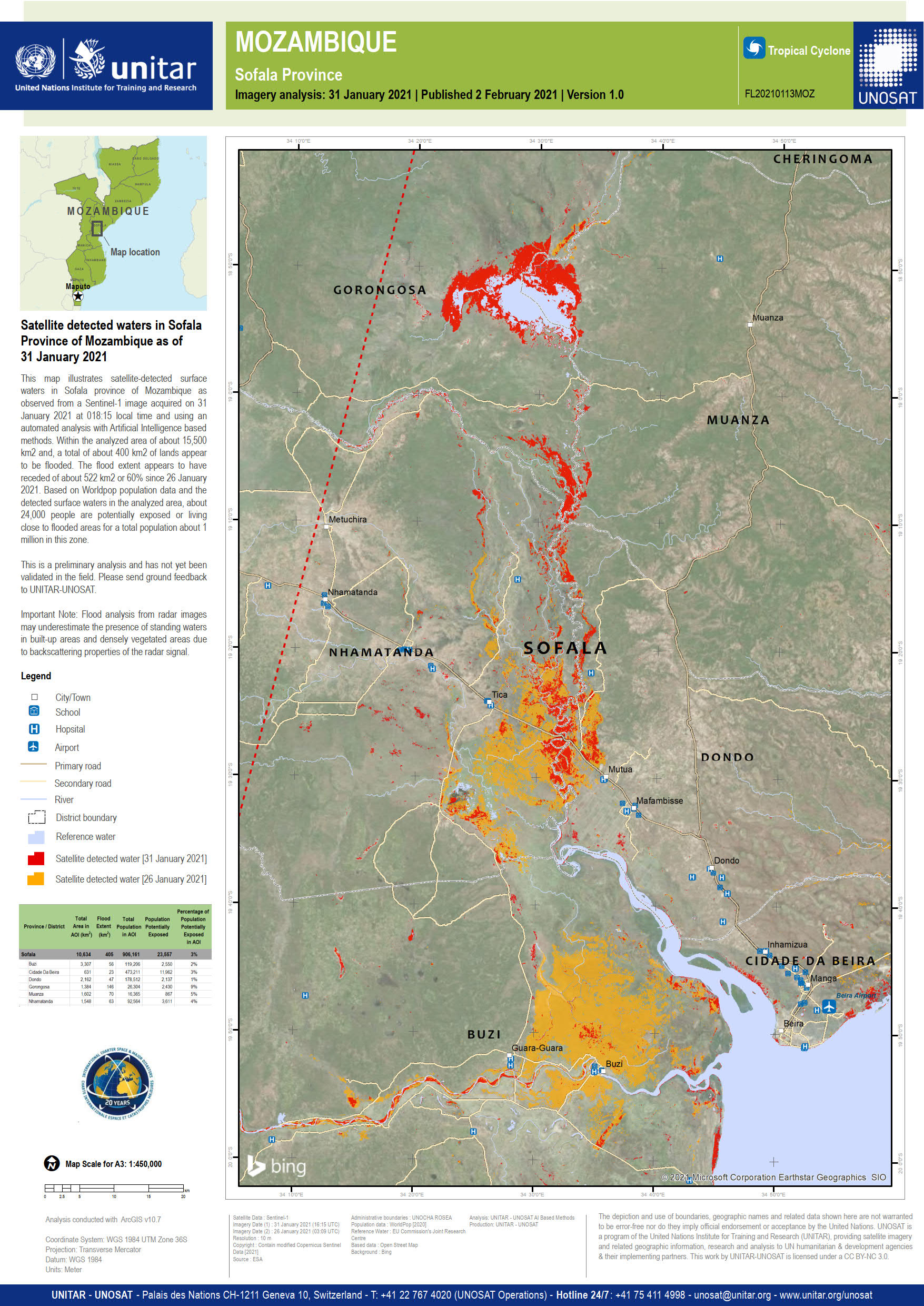
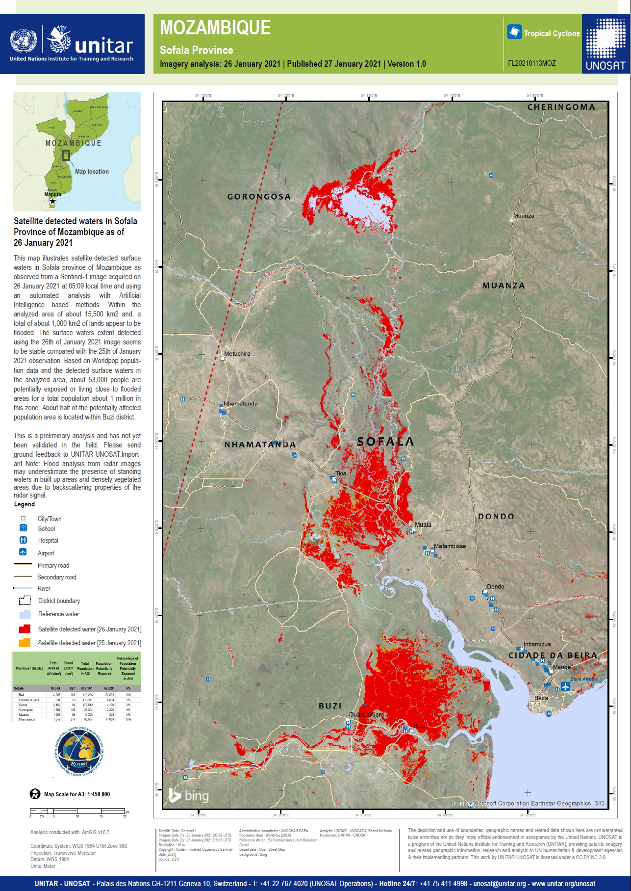
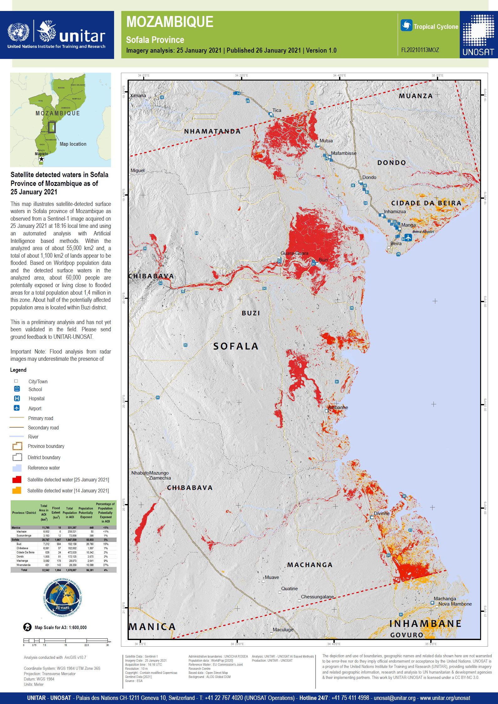
Preliminary Satellite derived flood assessment in Sofala province, Mozambique Download the full report
Copyright: Includes Pleiades material © CNES (2019), Distribution Airbus DS.
Information about the Product
Acquired: 28/01/2021 - 24/06/2019 - 20/07/2019
Source: Pleiades
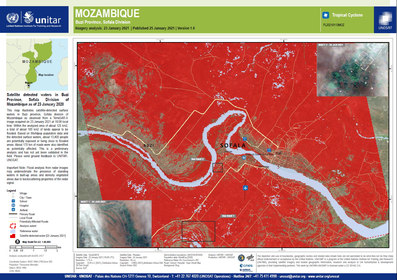
Satellite detected waters in Buzi Province, Sofala Division of Mozambique
Copyright: Includes Pleiades material © CNES (2021), Distribution Airbus DS.
© DLR e.V. (2021), Distribution Airbus DS Geo GmbH
Map produced by Unitar / UNOSAT
Information about the Product
Acquired: Pleiades: 24/01/2021
TerraSAR-X: 23/01/2021
Source: Pleiades / TerraSAR-X
 Back to the full activation archive

