 English
 Spanish
 French
 Chinese
 Russian
 Portuguese
 Última Activación
Charter activations
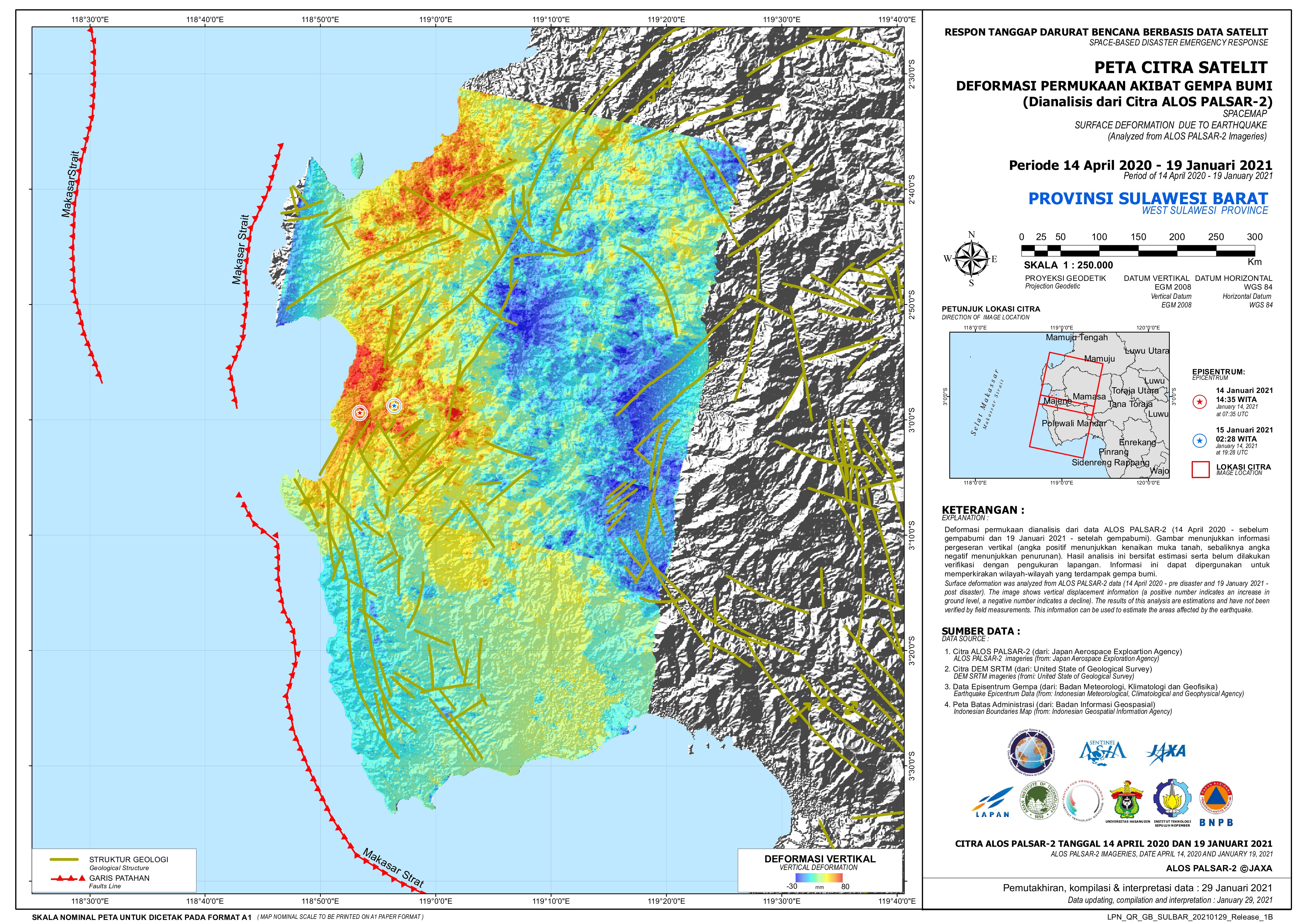
Earthquake in Indonesia
At least 42 people have died with hundreds more injured after a 6.2-magnitude earthquake hit Indonesia's Sulawesi Island on 15 January 2021, according to Indonesia's Disaster Management Agency.
The epicentre of the quake, which struck at 1:28 a.m. Jakarta time, was 6 kilometres (3.7 miles) northeast of the city of Majene, at a depth of 10 kilometres (6.2 miles), according to Indonesia's Meteorology, Climatology and Geophysics Agency.
34 people died in the city of Mamuju, to the north of the epicentre, while another eight died in Majene.
In Majene, at least 637 were injured and 15,000 residents have been displaced, according to the country's National Board for Disaster Management (BNPB).
| Type of Event: | Earthquake |
| Location of Event: | Indonesia |
| Date of Charter Activation: | 2021-01-15 |
| Time of Charter Activation: | 20:46 |
| Time zone of Charter Activation: | UTC+09:00 |
| Charter Requestor: | ADRC on behalf of Indonesia Institute of Aeronautics and Space (LAPAN) UNOOSA on behalf of BNPB, Indonesia (Disaster Management Agency of Indonesia) through LAPAN |
| Activation ID: | 695 |
| Project Management: | LAPAN |
Products


 Back to the full activation archive

