 English
 Spanish
 French
 Chinese
 Russian
 Portuguese
 Última Activación
Charter activations
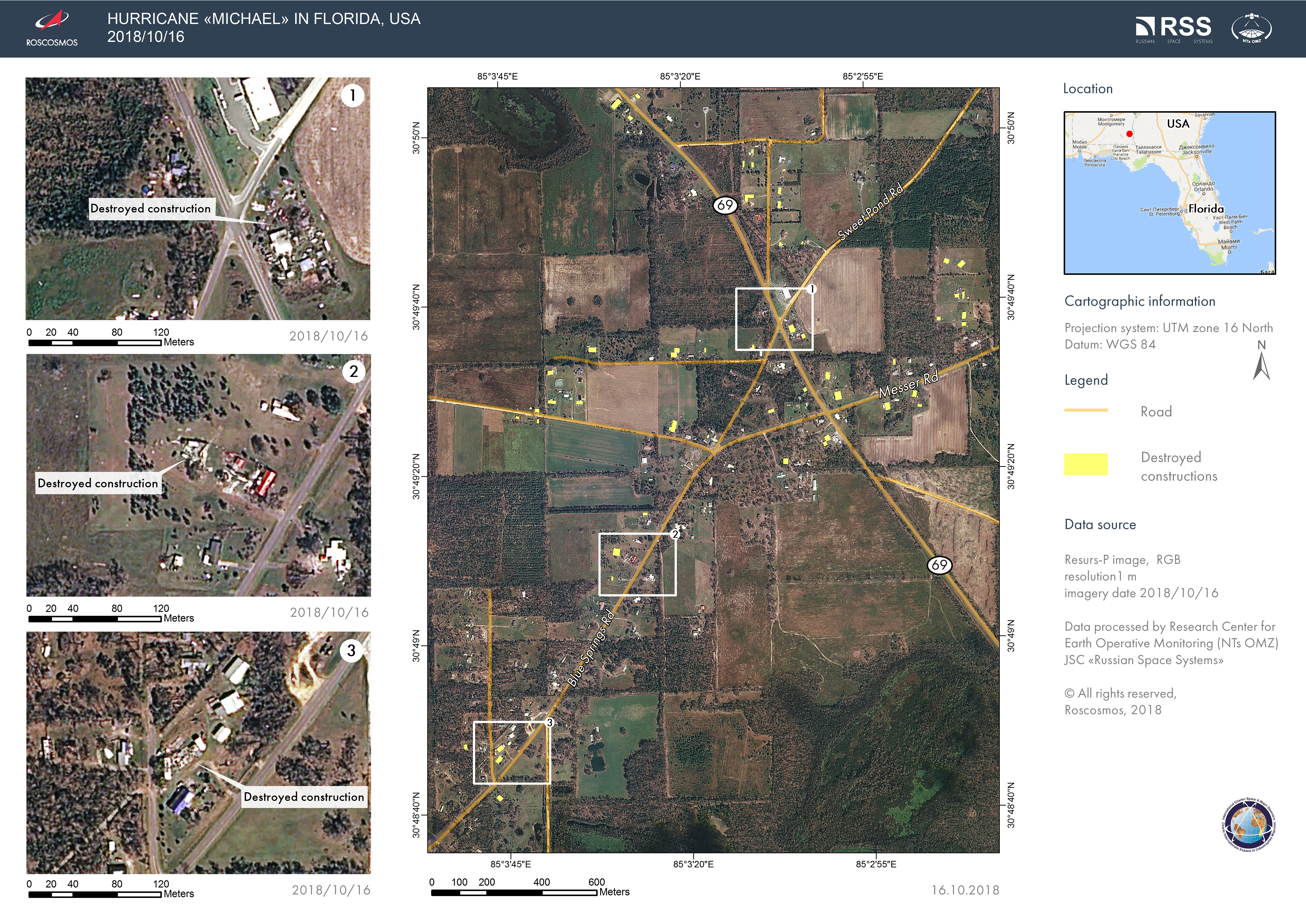
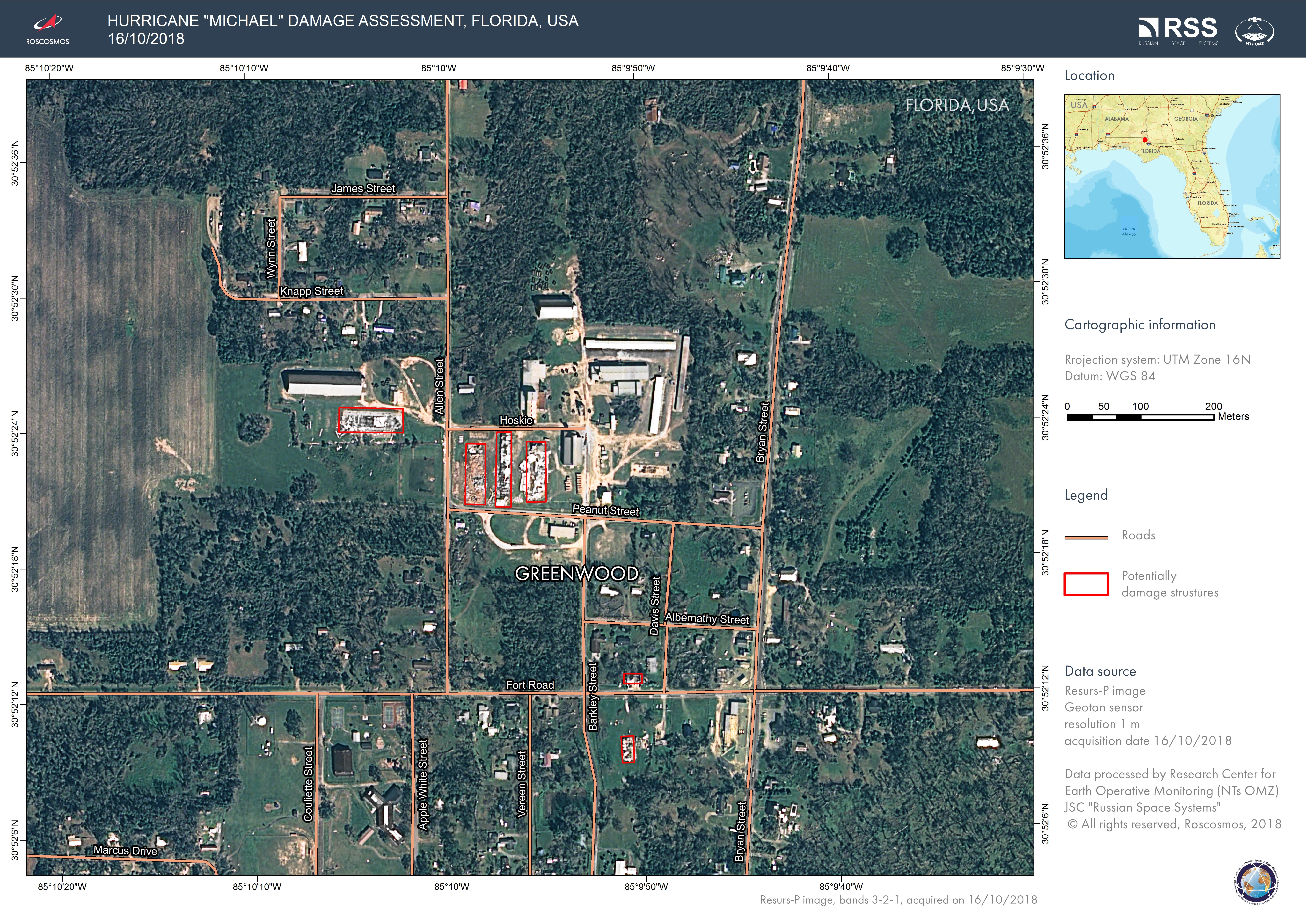
Hurricane Michael in the United States
Hurricane Michael, a category 4 storm made landfall at Mexico Beach, Florida on 10 October. Wind speeds of up to 155mph have caused severe damage to buildings and one person was killed by a falling tree.
500,000 people have been left without electricity in Florida, Alabama and Georgia, with the same amount of people being urged to seek higher ground across 20 counties.
President Trump declared a state of emergency for the entire state of Florida, releasing funds for disaster response. Over 2000 military personnel have been deployed together with helicopters and boats.
The governors of North and South Carolina urged residents to brace for more heavy rain and storm-force winds as Hurricane Michael moved northward.
Related News and Resources
| Type of Event: | Ocean Storm - Hurricane |
| Location of Event: | United States |
| Date of Charter Activation: | 2018-10-10 |
| Time of Charter Activation: | 17:51 |
| Time zone of Charter Activation: | UTC-05:00 |
| Charter Requestor: | USGS on behalf of Federal Emergency Management Agency (FEMA) |
| Activation ID: | 588 |
| Project Management: | University of Louisiana at Lafayette Regional Application Center (RAC) |
Products
 Back to the full activation archive

