 English
 Spanish
 French
 Chinese
 Russian
 Portuguese
 Latest Activation
Charter activations
Flood and ocean storm in El Salvador
Floods and landslides left at least 130 people dead in El Salvador after the Hurricane Ida ravaged parts of Central America. President Mauricio Funes described the disaster as a "tragedy" and said that the damage was "incalculable".
| Tipo de evento: | Floods, Hurricane, Landslide |
| Local do evento: | El Salvador |
| Data da Ativação da Carta: | 10/11/2009 |
| Requisitante da Carta: | UNITAR/UNOSAT on behalf of UN OCHA; USGS on behalf of Centro de Gobierno, El Salvador |
| Gerenciamento de projeto: | Cathalac |
Products
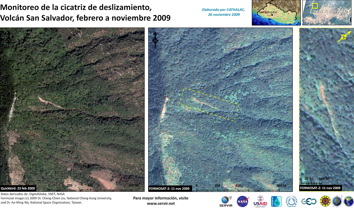
Landslide scar monitoring, Volcan San Salvador, February to November 2009
Direitos autorais: DigitalGlobe, SNET, NASA
Map created by Dr CC Liu, Universidad Nacional de Cheng Kung, Taiwan, RCO and Dr. An-Ming Wy, National Space Organization, Taiwan
Information about the Product
Adquirida: 23/02/2009, 11/11/2009
Fonte: QuickBird, Formosat-2
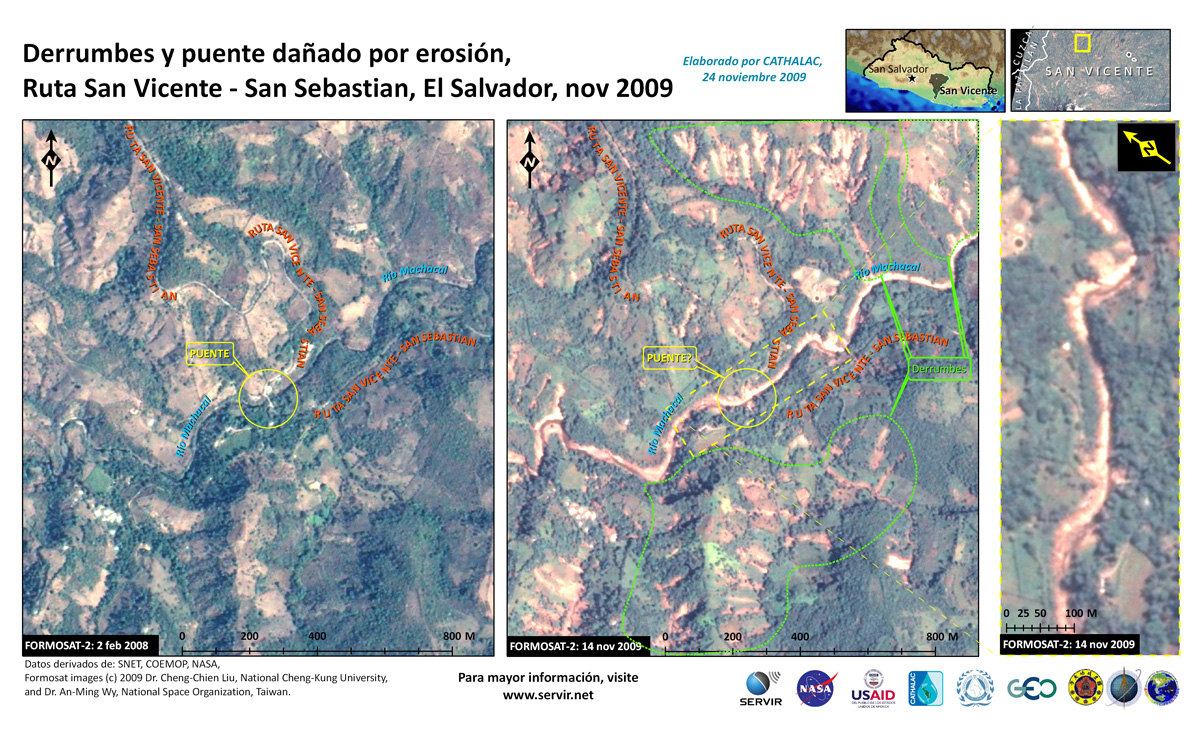
Landslides and bridge damaged by erosion, Route San Vicente - San Sebastian
Direitos autorais: NSPO, SNET, COEMOP, NASA
Map created by Dr CC Liu, Universidad Nacional de Cheng Kung, Taiwan, RCO and Dr. An-Ming Wy, National Space Organization, Taiwan
Information about the Product
Adquirida: 02/02/2008 and 14/11/2009
Fonte: Formosat-2


 Voltar ao arquivo completo da Ativação

