 English
 Spanish
 French
 Chinese
 Russian
 Portuguese
Ativações da Carta
Lista de Ativações
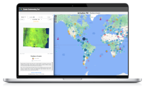
Browse the full archive of activations for the Charter, dating back to the first in 2000. See examples of maps produced for the Charter on each activation page, which use satellite data to observe the impact of natural and man-made disasters around the world. Use the filters to help navigate through the hundreds of disasters the Charter been activated for during more than 20 years of operations.
Tipo de Desastre
País ou Região
De
Para
