 English
 Spanish
 French
 Chinese
 Russian
 Portuguese
 Latest Activation
Charter activations
Eruption of Mount Semeru volcano in Indonesia
At least 14 people are dead and hundreds are displaced after Mount Semeru, a volcano in Indonesia's East Java province, erupted on Saturday 4 December, authorities said.
Many villages in Lumajang, in East Java, were coated in volcanic ash. At least 56 people have been injured, with many suffering burns after they mistook the hot mud flow for flooding.
The head of Indonesia's geological agency said heavy rain fall on the lip of Mt Semeru's crater caused it to partially collapse, triggering the eruption. There had been no increase in seismicity to suggest any change in magma flow it was reported.
Emergency teams and rescue dogs are looking for survivors and bodies in the debris. The operation has been complicated by dangerous conditions and bad weather in the area. The volcano remains active, with smaller eruptions continuing.
| Location of Event: | Indonesia |
| Date of Charter Activation: | 2021-12-07 |
| Time of Charter Activation: | 16:41 |
| Time zone of Charter Activation: | UTC+09:00 |
| Charter Requestor: | ADRC on behalf of Japan International Cooperation Agency |
| Activation ID: | 739 |
| Project Management: | Asian Institute of Technology |
Products

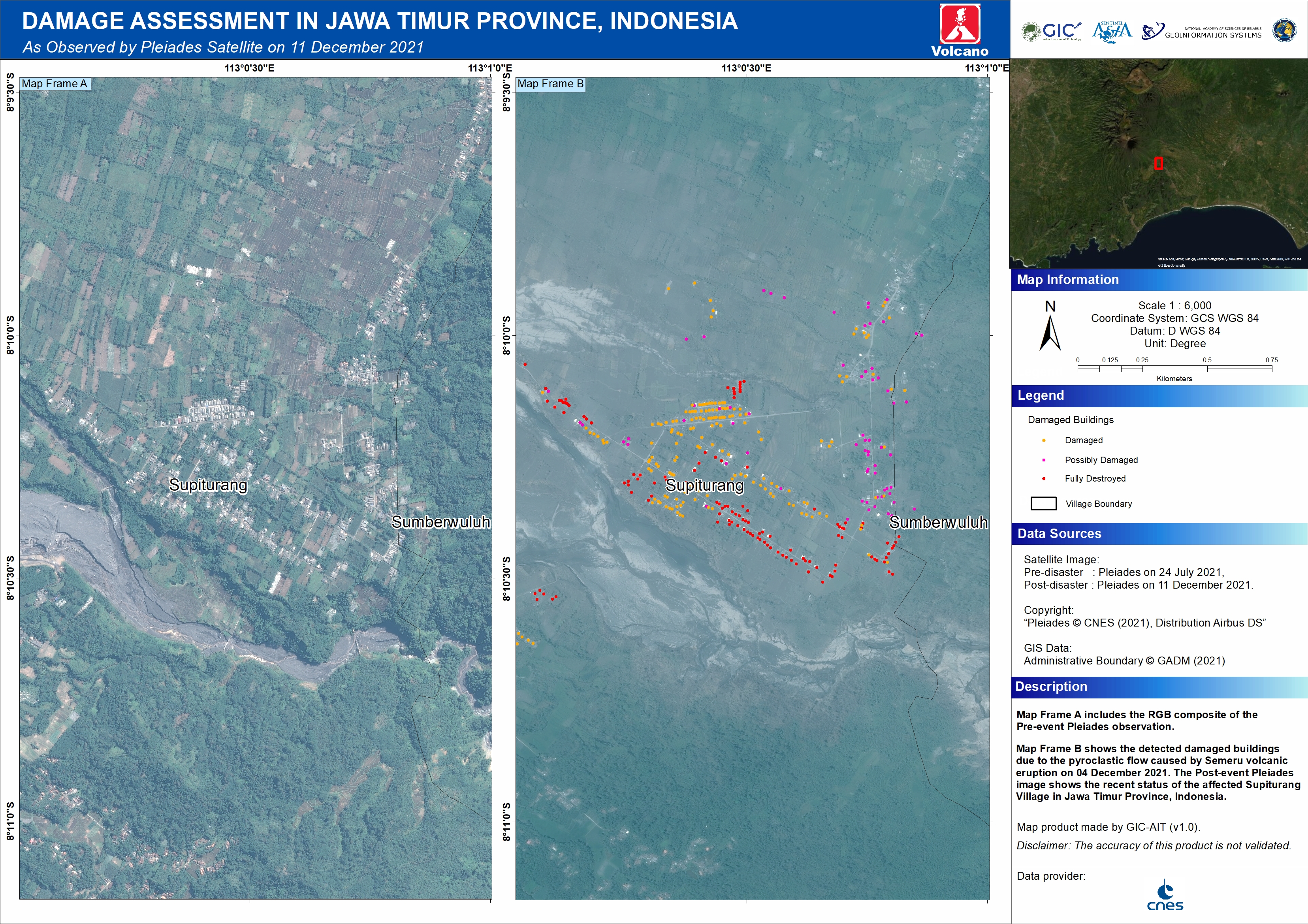
Estimation of buildings affected by the Semeru volcanic eruption
Download the full report
Copyright: Includes Pleiades material © CNES (2021), Distribution Airbus DS.
Map produced by GIC
Information about the Product
Acquired: 26/07/2021, 11/12/2021
Source: Pleiades
Category: Dossier
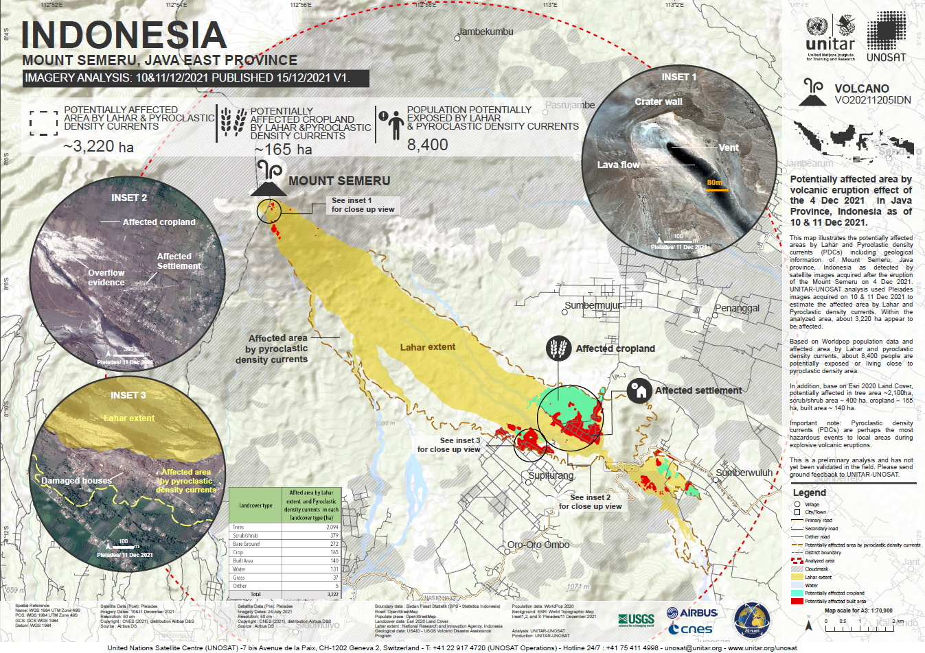
Potentially affected area by volcanic eruption of the 4 dec 2021 in Java Province, Indonesia
Copyright: Includes Pleiades material © CNES (2021), Distribution Airbus DS.
Map produced by UNITAR / UNOSAT
Information about the Product
Acquired: 10/12/2021, 11/12/2021
Source: Pleiades
Category: Grading Map


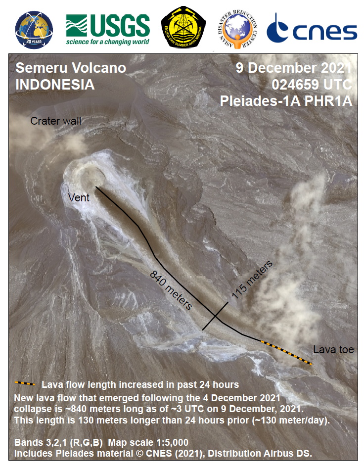
Preliminary damage assessment of Mount Semeru, East Java Province, Indonesia
Download the full report
Copyright: Includes Pleiades material © CNES (2021), Distribution Airbus DS.
Map produced by UNITAR - UNOSAT
Information about the Product
Acquired: 24/07/2021, 10/12/2021, 11/12/2021
Source: Pleiades
Category: Dossier

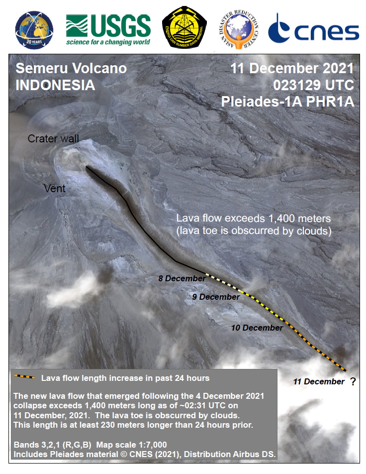
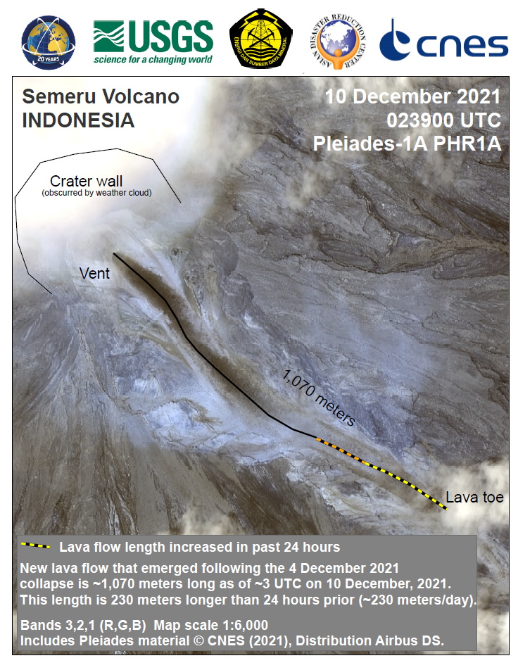
Preliminary Mapped Area of Measureable Impacts following the Dome Collapse from Semeru Volcano Summit Area
Copyright: Landsat 8 © US Geological Survey
Contains modified Copernicus Sentinel data (2021)
Includes Pleiades material © CNES (2021), Distribution Airbus DS
Vision-1 © Airbus Defence and Space Limited (2021)
Map produced by USGS.
Information about the Product
Acquired: Landsat 8: 05/02/2012
Sentinel-2: 26/10/2021 and 11/12/2021<
Pleiades: 24/07/2021, 09/12/2021, 10/12/2021 and 11/12/2021
Vision-1: 08/12/2021
Source: Sentinel-2, Vision-1, Pleiades and Landsat 8
Category: Reference Map


 Back to the full activation archive

