 English
 Spanish
 French
 Chinese
 Russian
 Portuguese
 Latest Activation
Charter activations
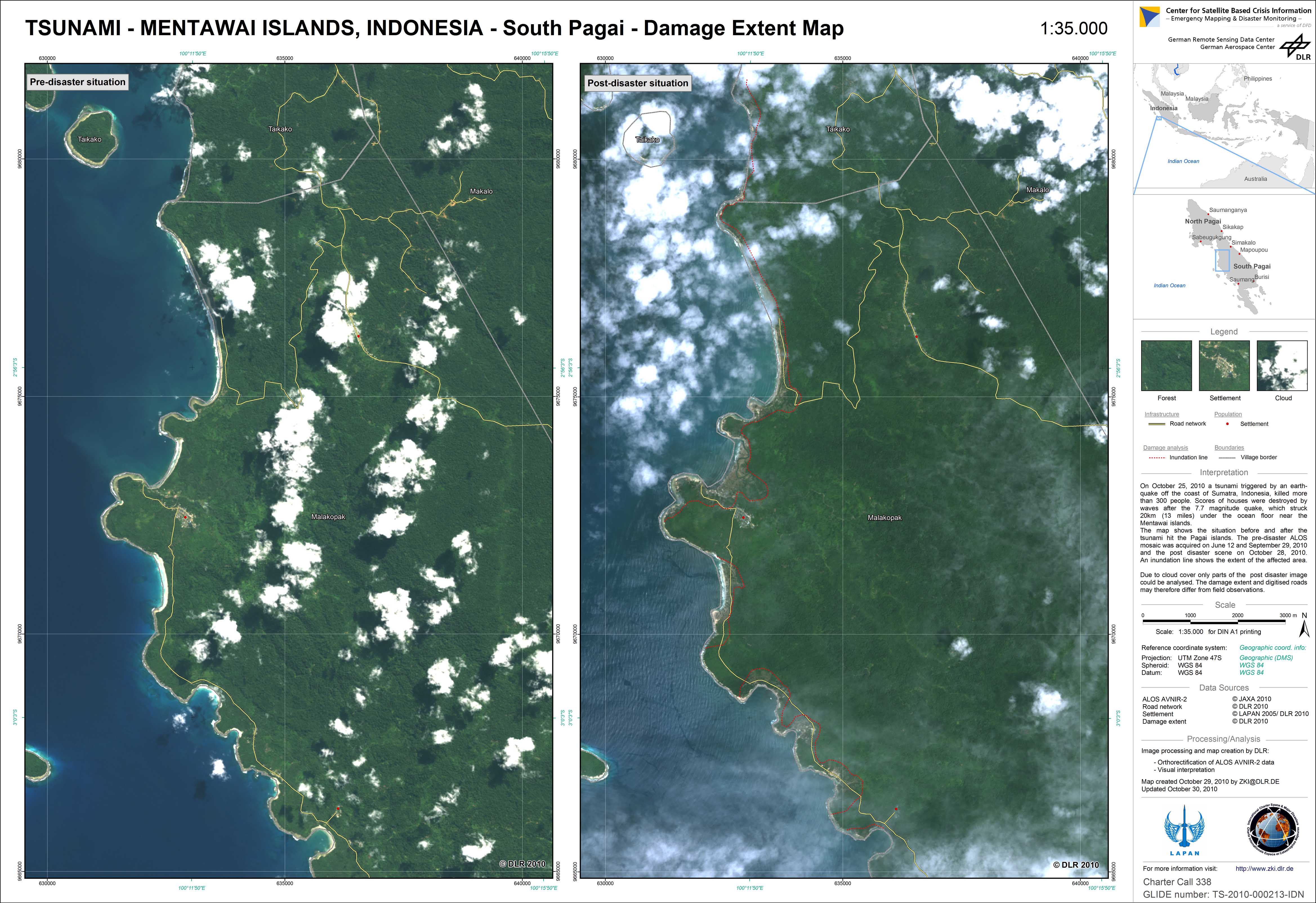
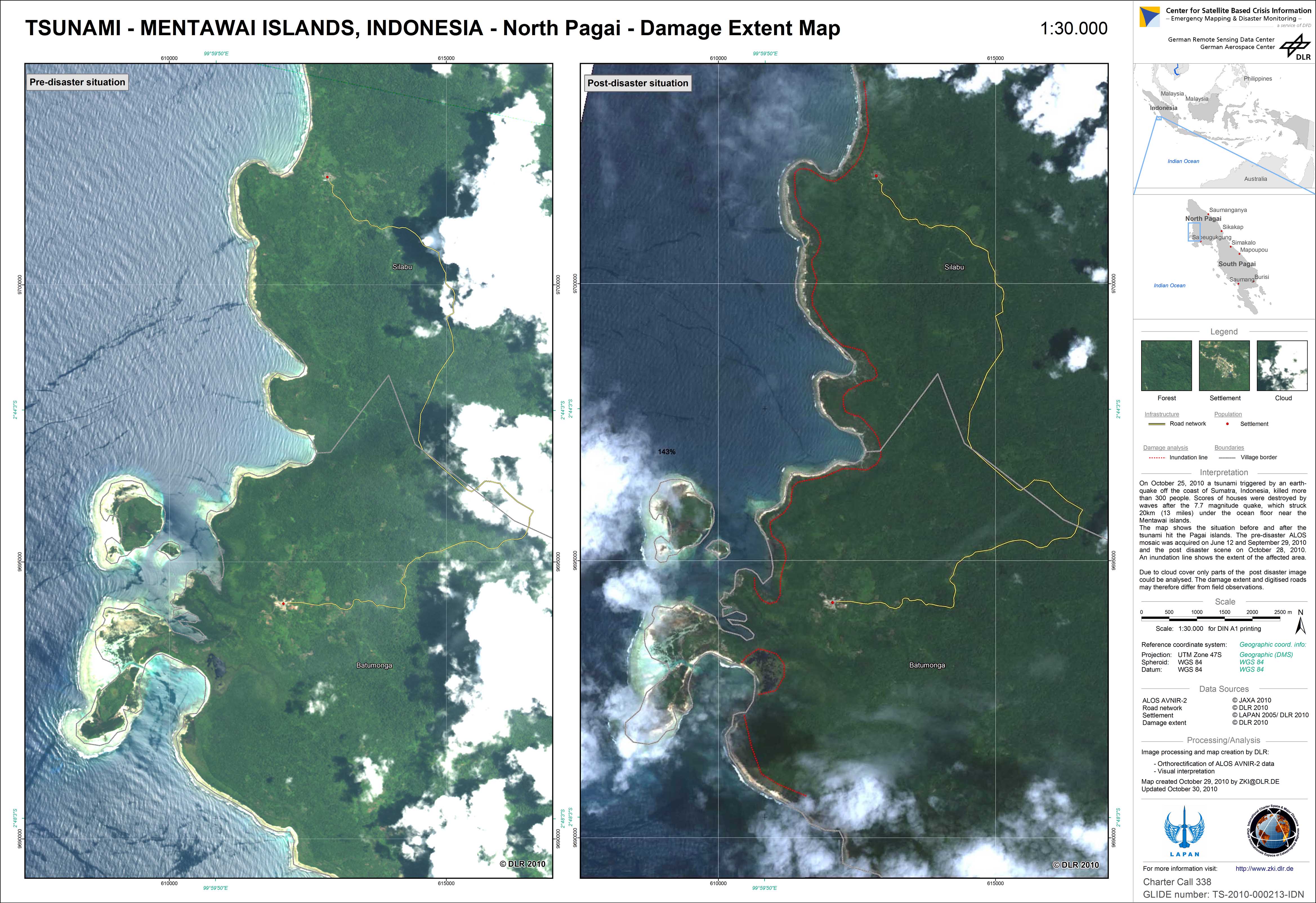
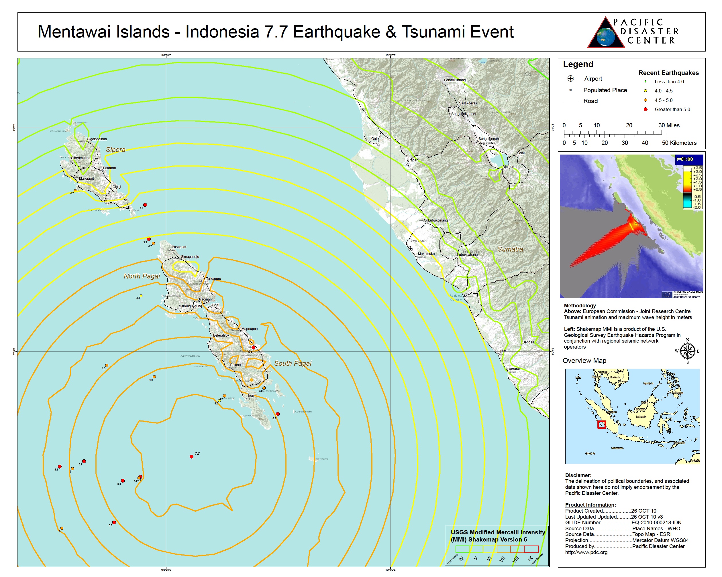
Tsunami in Sumatra, Indonesia
A two meter high tsunami struck Mentawai islands off the western coast of Sumatra, Indonesia following a 7.2 magnitude undersea earthquake on 25 October 2010 night.
More than 100 people have been killed and many more are missing after a tsunami triggered by an earthquake.
Request submitted via the Sentinel Asia escalation process
| Type of Event: | Tsunami |
| Location of Event: | Indonesia |
| Date of Charter Activation: | 28/10/2010 |
| Charter Requestor: | ADRC for Indonesia National Institute of Aeronautics and Space |
| Project Management: | AIT |
Products


 Back to the full activation archive

