 English
 Spanish
 French
 Chinese
 Russian
 Portuguese
 Latest Activation
Charter activations
Ice jam off the coast of Newfoundland
About 100 ships were trapped in sea ice off the coast of Newfoundland-Labrador.
| Type of Event: | Ice jam |
| Location of Event: | Canada |
| Date of Charter Activation: | 19/04/2007 14:30 UTC |
| Charter Requestor: | Public Safety Canada |
| Project Management: | CSA |
Products
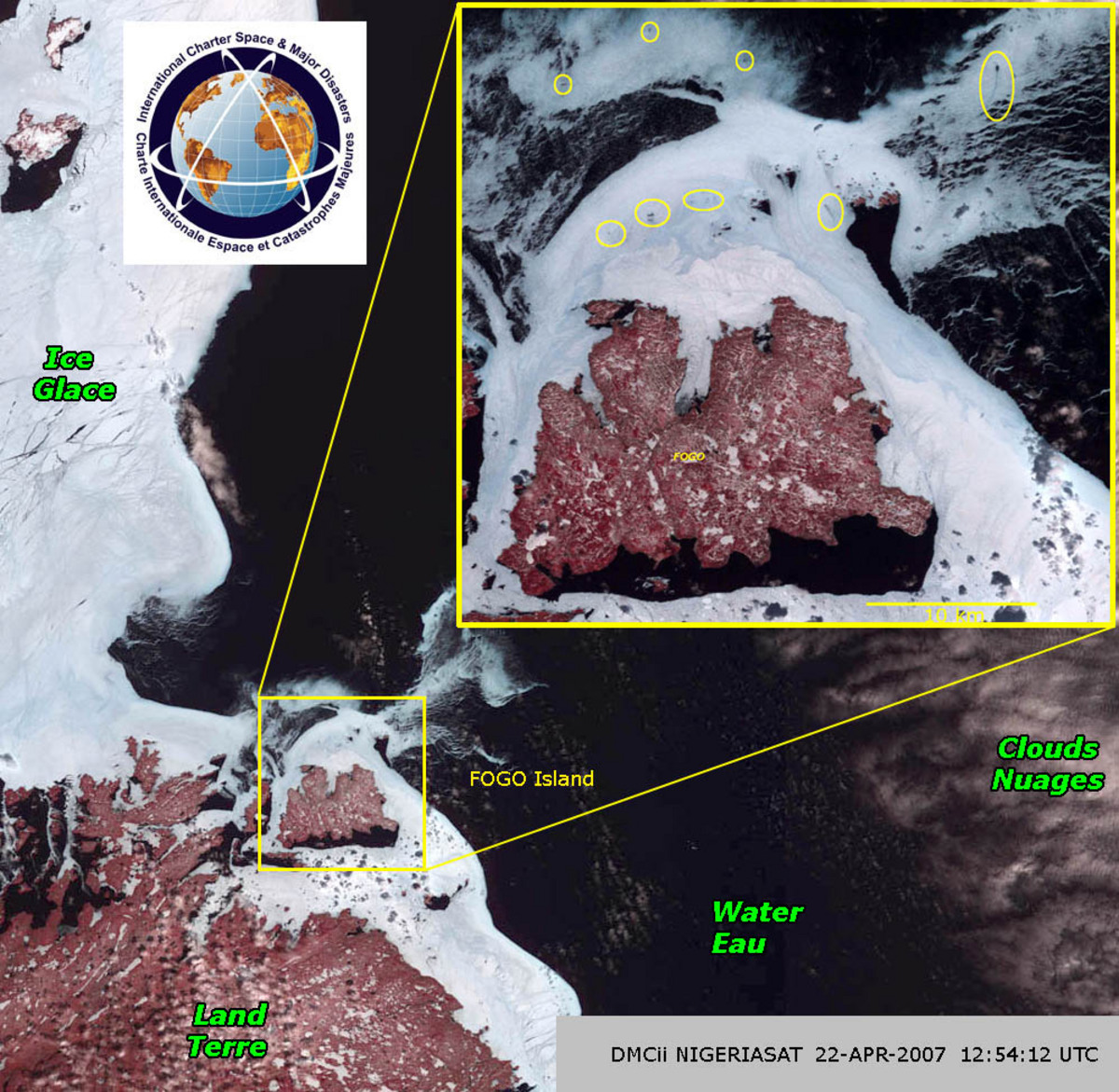
NigeriaSat-1, 22/04/2007
Copyright: DMC International Imaging 2007 Image processing, map created 22/04/2007 by CSA.
Information about the Product
Acquired: 22/04/2007 NigeriaSat-1 image showing shows the area of interest on April 22 around 10:30 a.m. Newfoundland time. The false-colour image shows the area around Fogo Island, where several darker spots in the ice pack indicate the positions of ice-bound vessels.
Source: NigeriaSat-1, resolution
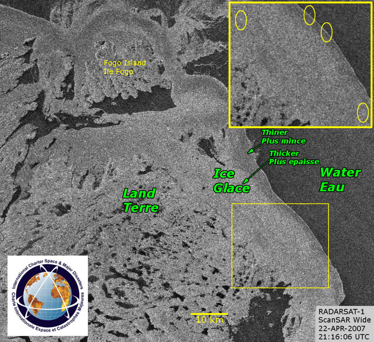
RADARSAT-1, 22/04/2007
Copyright: CSA 2007 Image processing, map created 22/04/2007 by CSA.
Information about the Product
Acquired: 22/04/2007 Image acquired by RADARSAT-1 ScanSAR (scanning synthetic aperture radar), with a wide beam that generates 100- metre pixels, resulting in a grainy image. The RADARSAT-1 image was acquired on April 22 at about 6:45 p.m. local time. The magnified insert reveals several shiny objects, possibly vessels imprisoned in the ice.
Source: RADARSAT-1, resolution 100m/pixel.
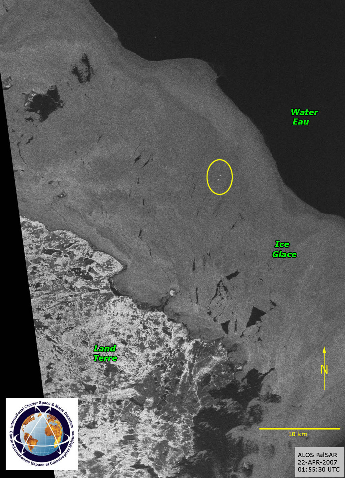
ALOS-1, 22/04/2007
Copyright: JAXA 2007 Image processing, map created 22/04/2007 by CSA.
Information about the Product
Acquired: 22/04/2007 ALOS SAR image which clearly delineates the three visible surfaces: land, the ice pack, and open water. Just above the centre of the image are two shiny spots surrounded by ice, which are probably two boats. This ALOS image was acquired just before 11:30 p.m. local time on April 22, and each pixel of the image represents a 12.5-metre square on the earth's surface.
Source: ALOS-1, resolution 12.5m/pixel.
 Back to the full activation archive

