Minimize Latest Activation

Charter activations

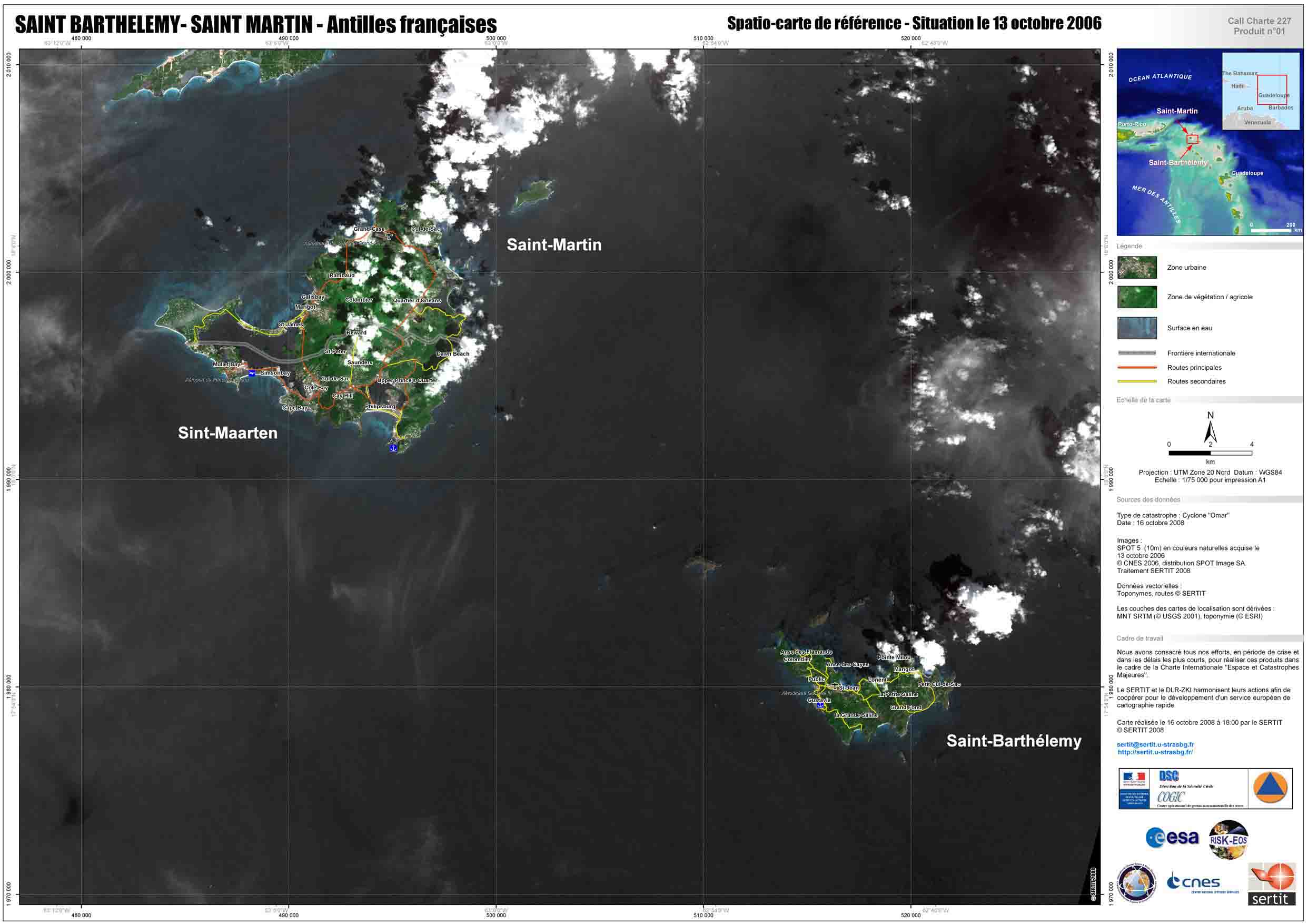
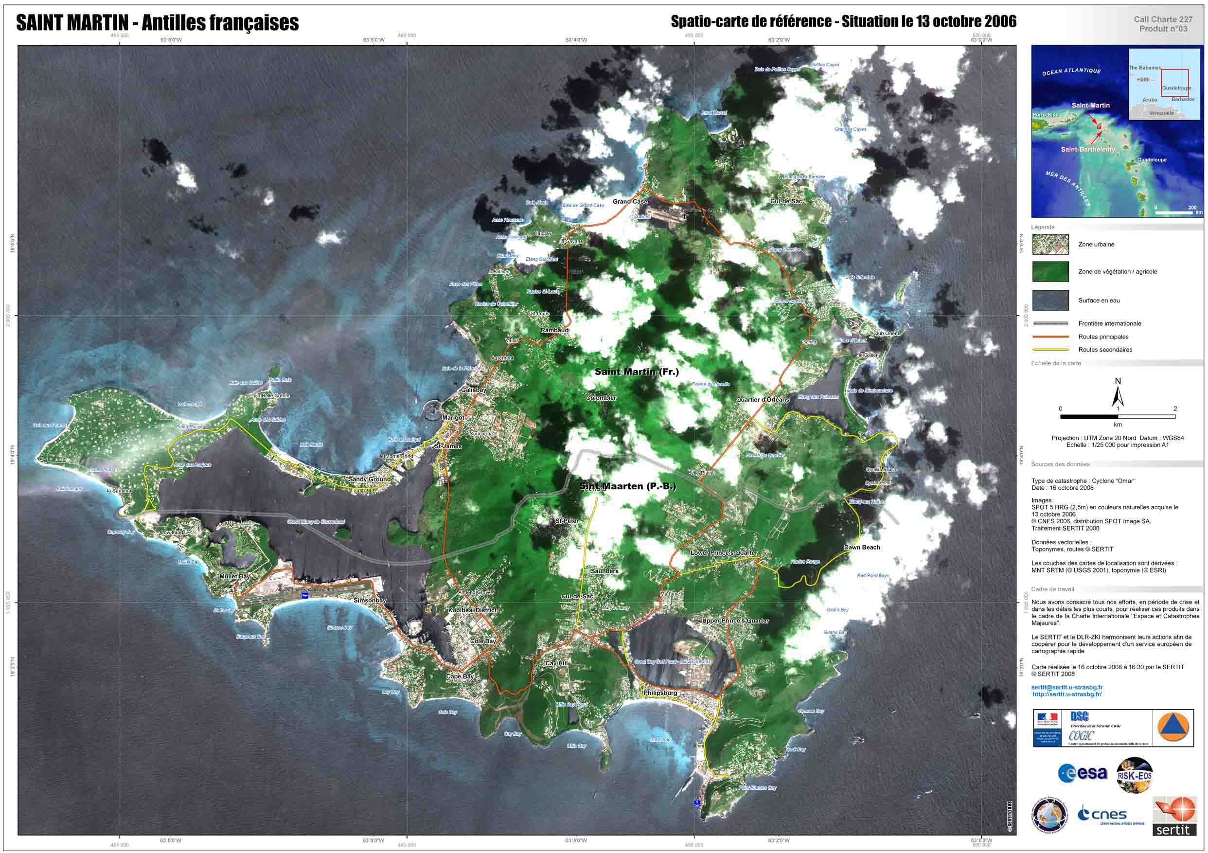
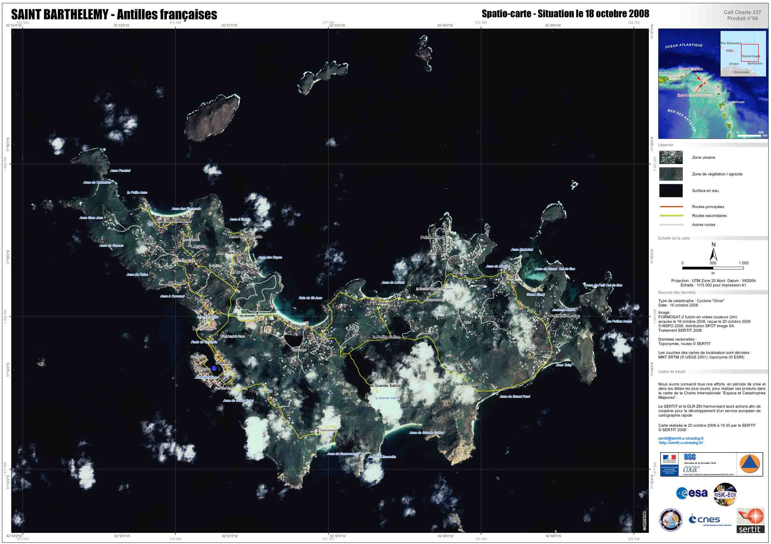
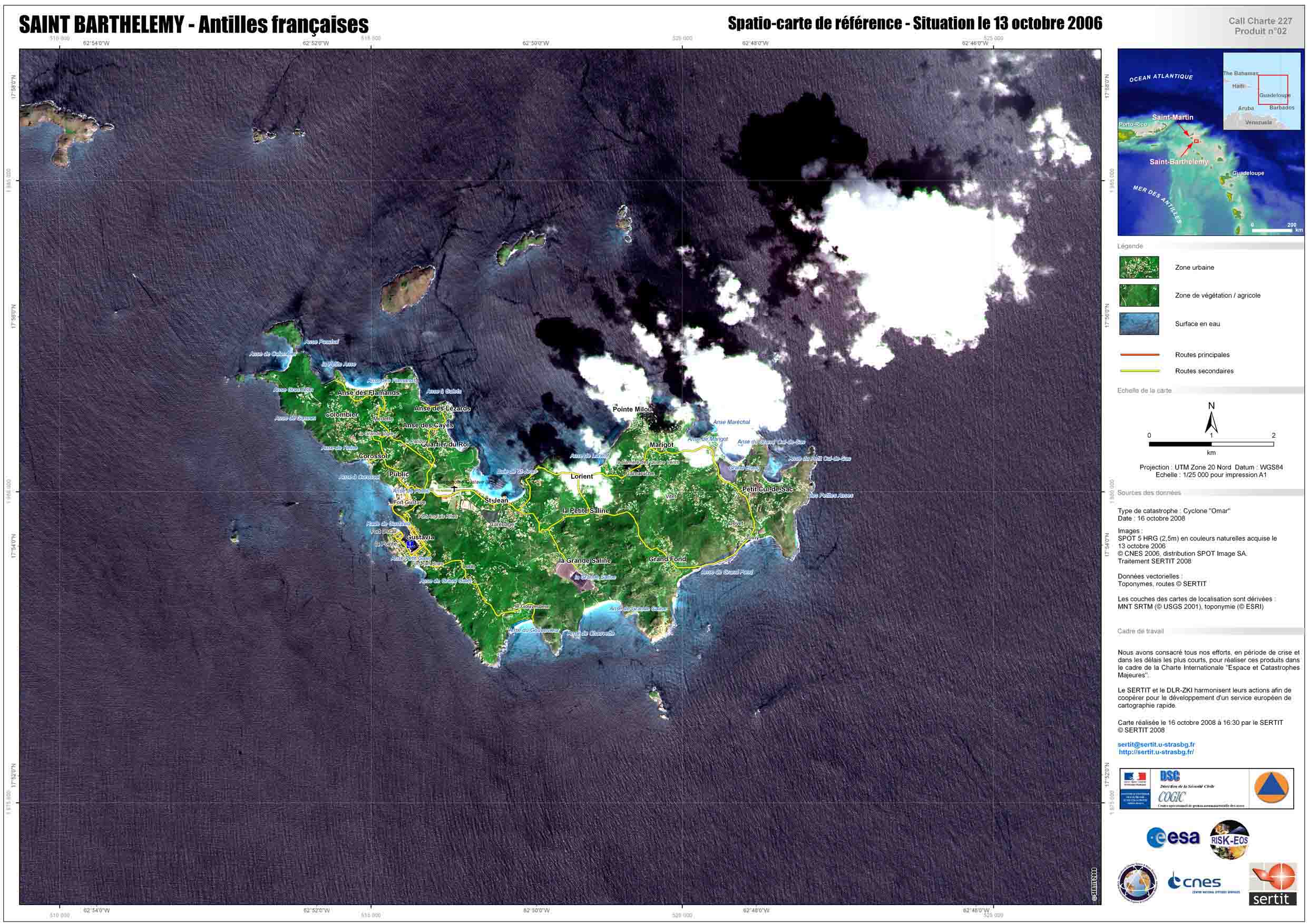
Hurricane on Guadeloupe, Saint Martin and Saint-Barthélemy islands

Hurricane Omar crossed the northern Leeward Islands as a major Category 3 storm. Warnings are being issued for other islands in the Caribbean Sea as the hurricane moves northeastward.

Type of Event:Hurricane
Location of Event:Guadeloupe, Saint Martin and Saint-Barthélemy
Date of Charter Activation:15/10/2008
Charter Requestor:DSC / COGIC
Project Management:CNES

Products

Saint Martin and Saint Barthélémy (French Antilles), Reference Space map

Copyright: CNES 2006, distribution SPOT Image SA Image processing, map created 16/10/2008 by SERTIT

Information about the Product

Acquired: 13/10/2006

Source: SPOT 5, 10m resolution.

Saint Martin, Reference Space map

Copyright: CNES 2006, distribution SPOT Image SA Image processing, map created 16/10/2008 by SERTIT.

Information about the Product

Acquired: 13/10/2006

Source: SPOT 5 HRG, 2,50m resolution

Saint Barthélémy, Situation Space map

Copyright: NSPO 2008, distribution SPOT Image SA Image processing, map created 20/10/2008 by SERTIT

Information about the Product

Acquired: 18/10/2008

Source: FORMOSAT-2, 2m resolution.

Saint Barthélémy, Reference Space map

Copyright: CNES 2006, distribution SPOT Image SA Image processing, map created 16/10/2008 by SERTIT.

Information about the Product

Acquired: 13/10/2006

Source: SPOT 5 HRG, 2,50m resolution

Back to the full activation archive