 English
 Spanish
 French
 Chinese
 Russian
 Portuguese
 Latest Activation
Charter activations
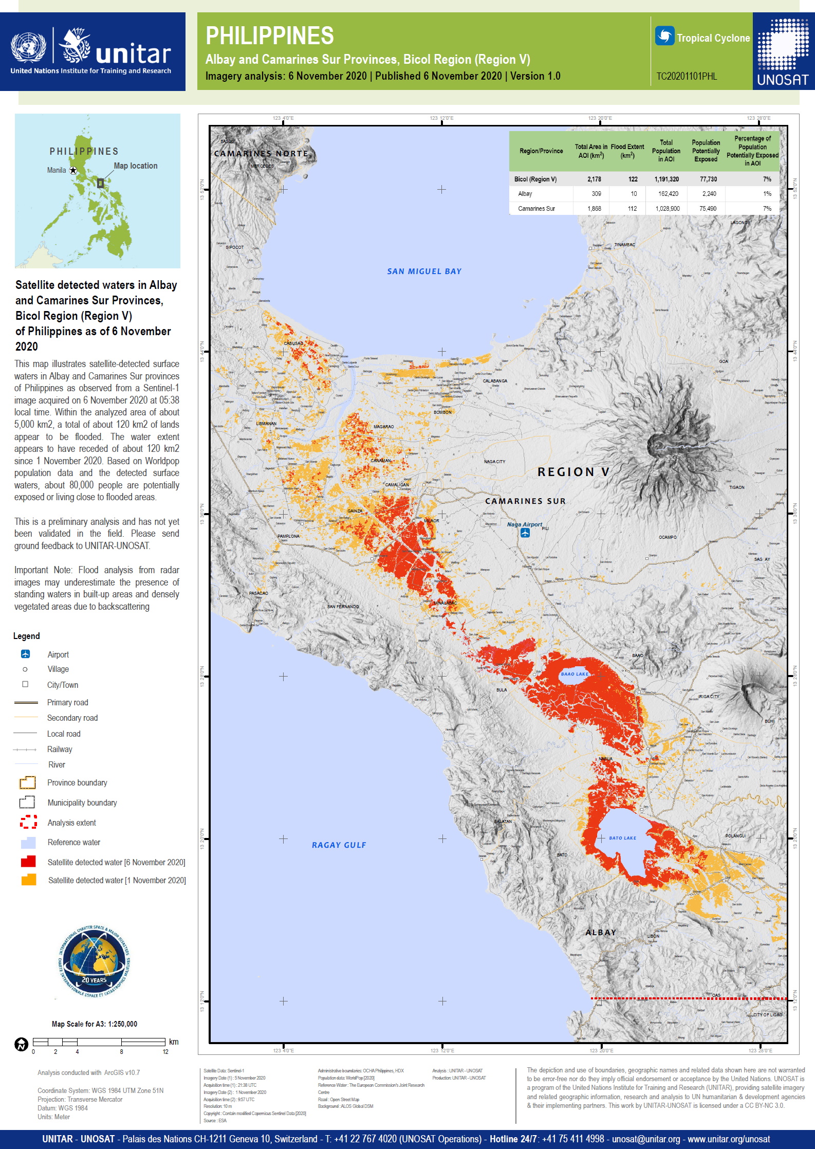
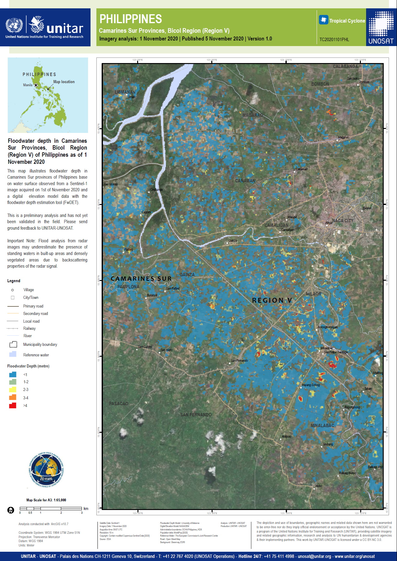
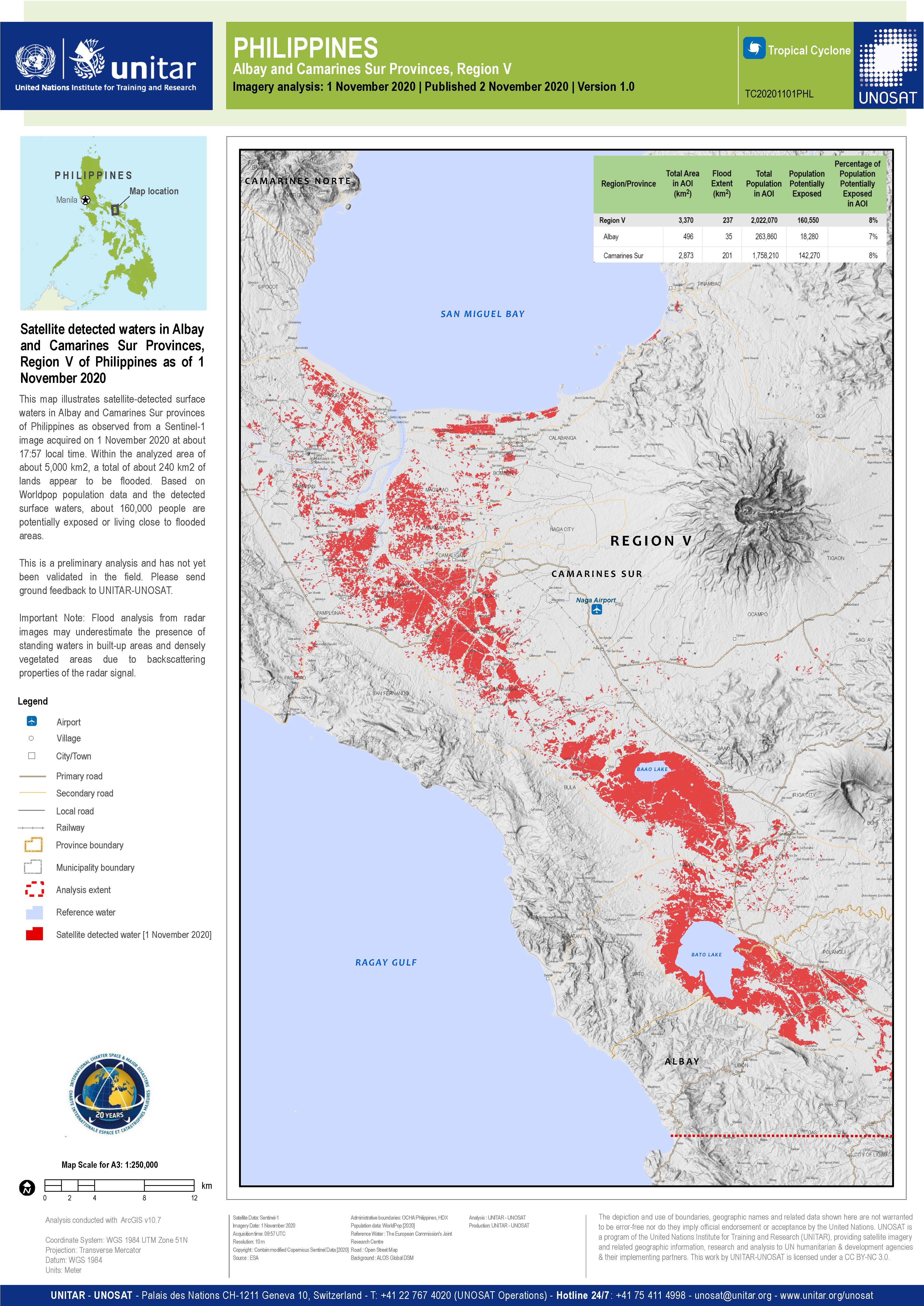
Typhoon Goni in Philippines
Typhoon Goni made landfall as a super typhoon at Catanduanes Island with wind speeds of over 140mph. At least 10 people have been killed.
The storm brought storm surges and flash flooding, which caused power outages and damaged infrastructure. The Philippines national disaster agency reported that up to 19 million people would be affected by Goni, and that the population was in danger zones for landslides, floods and storm surge.
The main Luzon island has been badly affected as has the Quezon province, where power supplies were cut in more than 10 towns.
Disaster management agencies and a regional civil defence spokesman reported teh evacuation of people being more difficult because of Covid-19.
Goni has continued to travel west, and although weakening, still has sustained wind speeds of 90mph.
| Type of Event: | Floods |
| Location of Event: | Philippines |
| Date of Charter Activation: | 2020-11-02 |
| Time of Charter Activation: | 12:03 |
| Time zone of Charter Activation: | UTC+09:00 |
| Charter Requestor: | ADRC on behalf of PHIVOLCS DOST UNITAR on behalf of United Nations Office for the Coordination of Humanitarian Affairs (OCHA) | Regional Office for Asia and the Pacific (ROAP) |
| Activation ID: | 682 |
| Project Management: | Philippine Institute of Volcanology and Seismology (PHIVOLCS) |
Products

Field-validated Lahar Flow Deposits and Mayon Volcano Lahar Hazard Data (from 2018) in the Municipality of Guinobatan, Province of Albay, Philippines
Copyright: Includes Pleiades material © CNES (2020), Distribution Airbus DS.
Map produced by DOST-PHIVOLCS
Information about the Product
Acquired: 13/11/2020
Source: Pleiades

Preliminary satellite-derived damage assessment of Daraga and Legazpi City, Albay Province, Bicol Region, Philippines
Download the full report
Copyright: WorldView-2 © (2020) DigitalGlobe, Inc., Longmont CO USA 80503. DigitalGlobe and the DigitalGlobe logos are trademarks of DigitalGlobe, Inc. The use and/or dissemination of this data and/or of any product in any way derived there from are restricted. Unauthorized use and/or dissemination is prohibited
Includes Pleiades material © CNES (2020), Distribution Airbus DS.
Report produced by UNITAR/UNOSAT
Information about the Product
Acquired: WorldView-2: 26/05/2020
Pleiades: 06/11/2020
Source: WorldView-2 / Pleiades

 Back to the full activation archive

