 English
 Spanish
 French
 Chinese
 Russian
 Portuguese
 Latest Activation
Charter activations
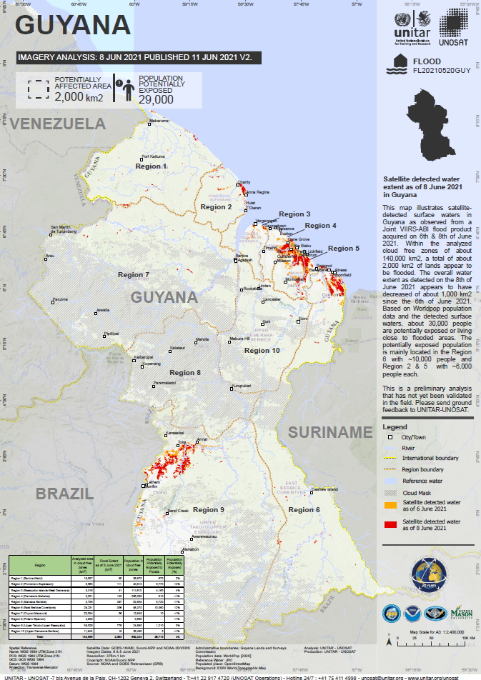
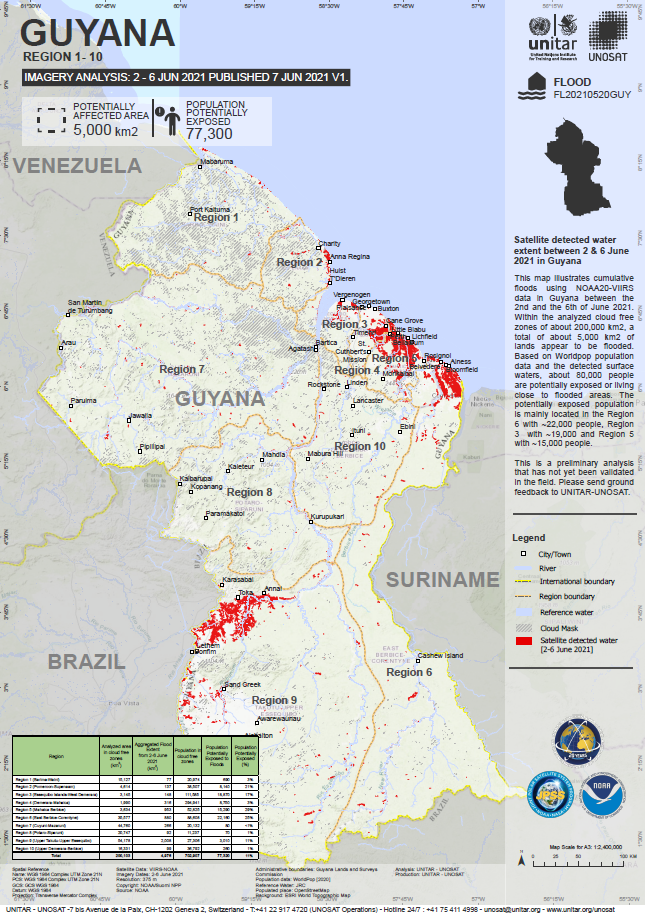
Flooding in Guyana
Widespread flooding has inundated Guyana, swamping roads, homes and farmland throughout the small South American country. More than 6,900 households have been severely affected by the flooding in the past weeks, according to government estimates.
President Irfaan Ali has said that the flooding currently occurring is one of the worst disasters the country has ever faced and projected that it will take some time for it to recover once the situation has abated.
Despite a respite in some areas, floodwater has remained at significant levels in most of the country's regions as authorities continued to mobilise help for victims.
| Location of Event: | Guyana |
| Date of Charter Activation: | 2021-06-07 |
| Time of Charter Activation: | 12:16 |
| Time zone of Charter Activation: | UTC+02:00 |
| Charter Requestor: | UNITAR on behalf of WFP |
| Activation ID: | 717 |
| Project Management: | UNITAR |
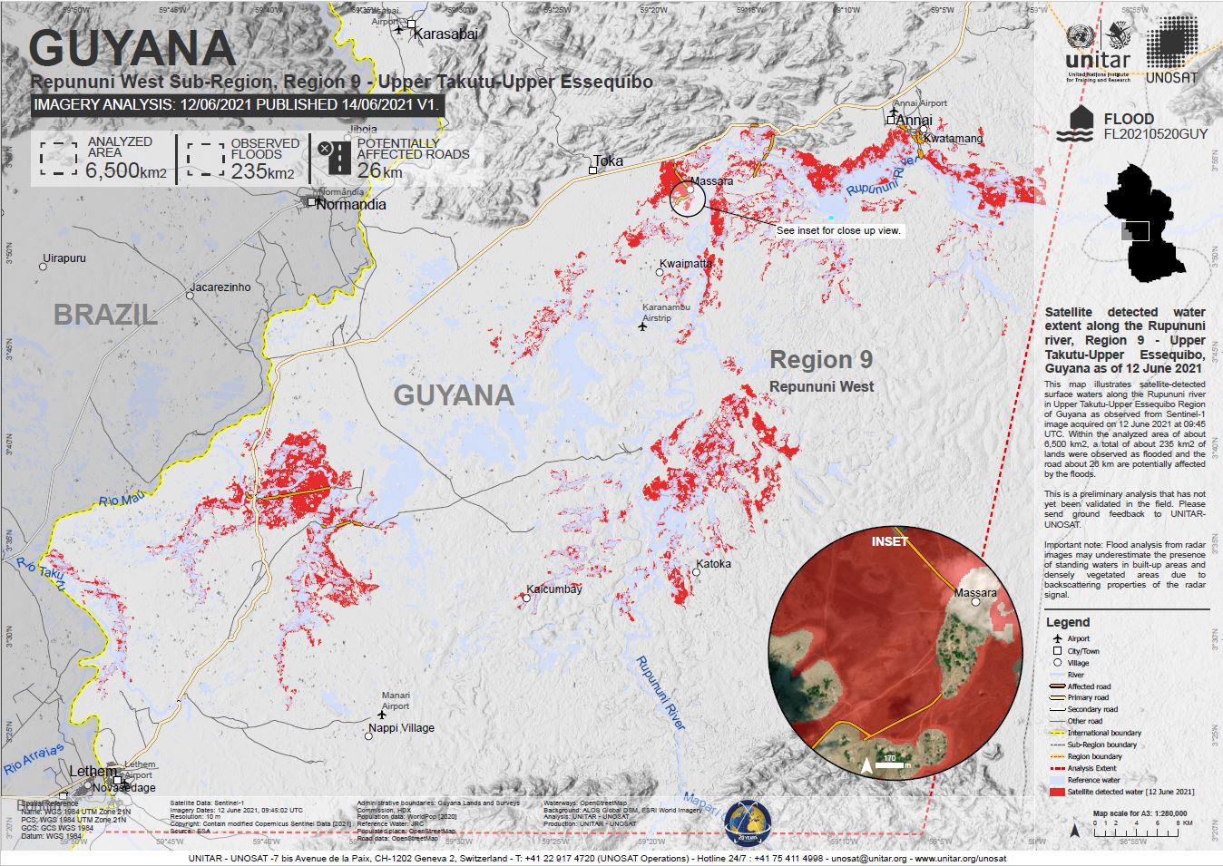
Products
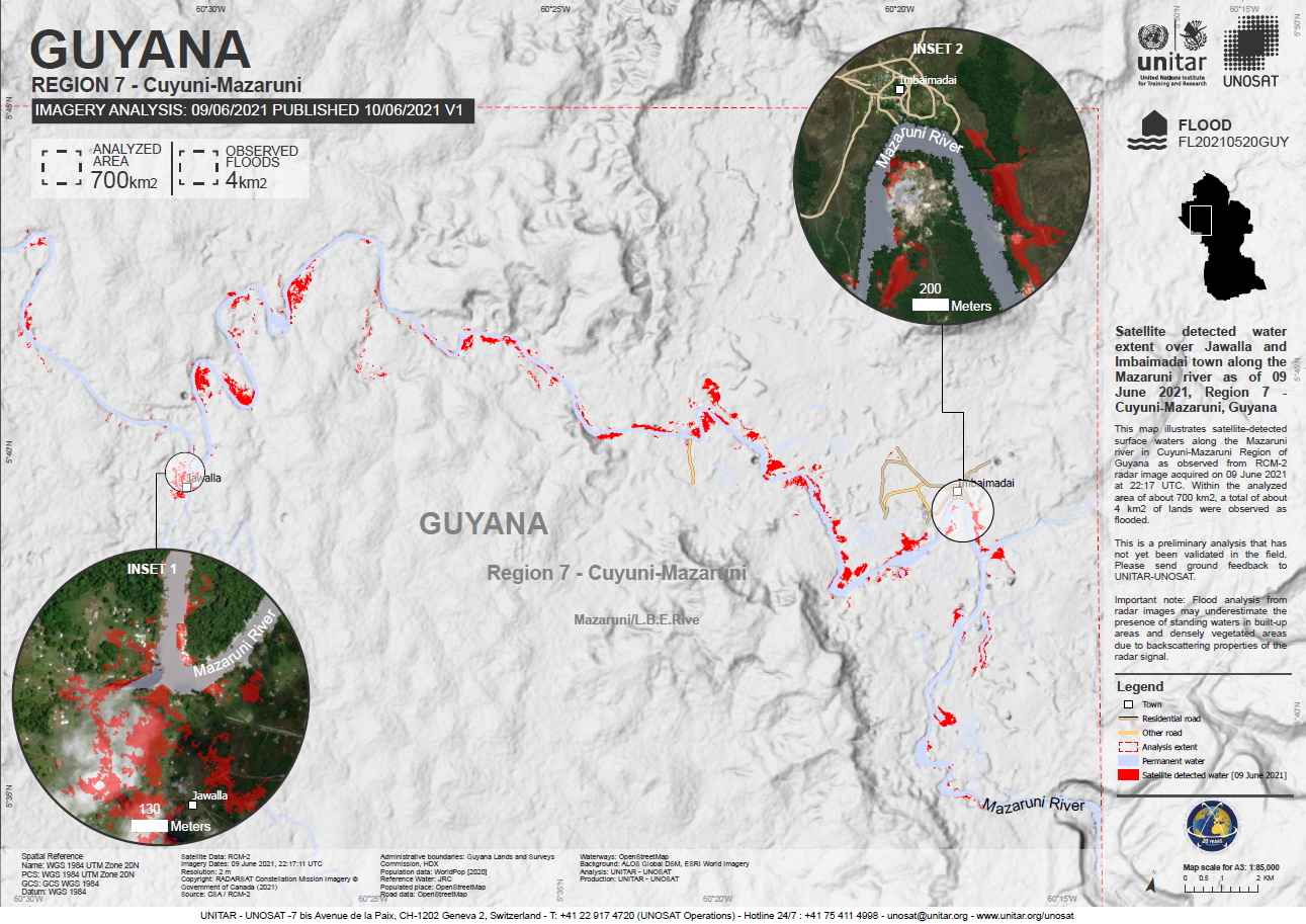
Satellite detected water extent along the Mazaruni river, Cuyuni - Mazuruni, Guyana.
Copyright: RADARSAT Constellation Mission Imagery © Government of Canada (2021) - RADARSAT is an official mark of the Canadian Space Agency
Map produced by UNITAR / UNOSAT
Information about the Product
Acquired: 09/06/2021
Source: RCM
Preliminary satellite derived flood assessment Guyana
Download full report
Copyright: © DLR e.V. (2021), Distribution Airbus DS Geo GmbH
Map produced by UNITAR / UNOSAT
Information about the Product
Acquired: 08/06/2021
Source: TerraSAR-X
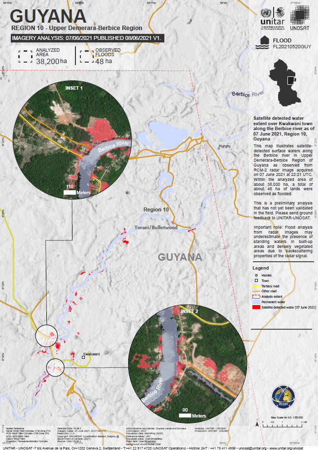
Satellite detected flooding extent over Kwakwani town along the Berbice river, region 10, Guyana.
Copyright: RADARSAT Constellation Mission Imagery © Government of Canada (2021) - RADARSAT is an official mark of the Canadian Space Agency
Map produced by UNITAR / UNOSAT
Information about the Product
Acquired: 07/06/2021
Source: RCM
 Back to the full activation archive

