 English
 Spanish
 French
 Chinese
 Russian
 Portuguese
 Latest Activation
Charter activations
Flooding in Brazil
More heavy rain caused flooding and landslides in areas of Manaus, the capital of the state of Amazonas in Brazil. It has been reported that many homes have been lost and over 135 incidents of flooding and landslides occurred across the city as a result of the heavy rainfall on 25 March.
Around 113 mm of rain fell in the east of the city in a few hours with the Armando Mendes and Gilberto Mestrinho neighbourhoods in particular being badly affected. Other affected areas were in the Japiim neighbourhood.
Federal Government Ministers of Regional Development of Brazil visited the city. They toured some of the affected areas to assess the immediate need for resources for the Amazonas State capital.
| Type of Event: | Floods |
| Location of Event: | Brazil |
| Date of Charter Activation: | 2023-03-28 |
| Time of Charter Activation: | 10:49 |
| Time zone of Charter Activation: | UTC-03:00 |
| Charter Requestor: | CENAD |
| Activation ID: | 815 |
| Project Management: | Pedro Youssef (CENAD) |
| Value Adding: | Artur Jose Soares Matos (SGB) Jose BisinotiNeto (CENAD) Konstantin Homenkov (Geoniformation systems) Regla Somoza (CEMADEN) |
Products


The Flood Situation in Brasiléia, Acre, Brazil
Copyright: Includes Pleiades material © CNES (2023), Distribution Airbus DS.
Map produced by CENAD and INPE.
Information about the Product
Acquired: PlanetScope: 08/01/2023
Pleiades: 30/03/2023
Source: PlanetScope and Pleiades
Category: Gradient Monitoring Maps

Flooded Areas in Rio Branco, State of Acre, Brazil
Copyright: © (2023) DigitalGlobe, Inc., Longmont CO USA 80503. DigitalGlobe and the DigitalGlobe logos are trademarks of DigitalGlobe, Inc.
The use and/or dissemination of this data and/or of any product in any way derived there from are restricted.
Unauthorized use and/or dissemination is prohibited.
Map produced by CENAD and INPE.
Information about the Product
Acquired: 31/03/2023
Source: WorldView-1
Category: Delineation Map
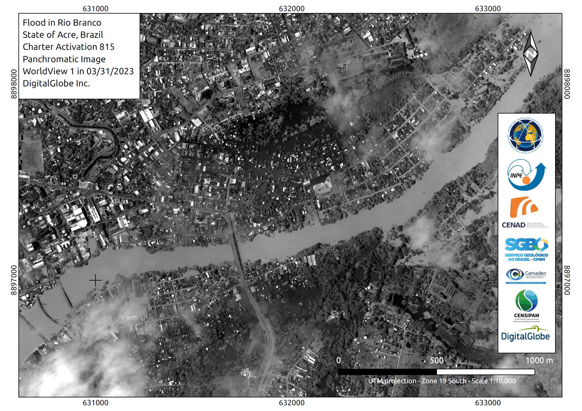
Flooding in Rio Branco, State of Acre, Brazil
Copyright: © (2023) DigitalGlobe, Inc., Longmont CO USA 80503. DigitalGlobe and the DigitalGlobe logos are trademarks of DigitalGlobe, Inc.
The use and/or dissemination of this data and/or of any product in any way derived there from are restricted.
Unauthorized use and/or dissemination is prohibited.
Map produced by CENAD and INPE.
Information about the Product
Acquired: 31/03/2023
Source: WorldView-1
Category: Reference Map


The flood situation in Brasileia, Brazil
Copyright: © Planet Labs Inc. (2023)
Includes Pleiades material © CNES (2023), Distribution Airbus DS.
Map produced by UE "Geoinformation Systems"
Information about the Product
Acquired: PlanetScope: 28/03/2023
Pleiades: 02/04/2023
Source: PlanetScope and Pleiades
Category: Delineation Map


 Back to the full activation archive

