Latest Activation
Charter activations
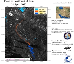
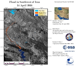
Flood in Iran
Western and southwestern parts of Iran are suffering major flooding following days of heavy rain.
Over 2500 people have been evacuated from several provinces and over a hundred cities are reported to have suffered damage and flooding.
The flooding has struck the provinces of Lorestan, Ilam, Kermanshah, Fars, Khuzestan, Chaharmahal, Bakhtiari and Kurdistan.
The disaster has cut electricity supplies and water to thousands of people, and dams throughout the region are close to their limit as the rain continues to raise water levels ever higher.
| Type of Event: | Flood |
| Location of Event: | Islamic Republic of Iran |
| Date of Charter Activation: | 15 April 2016 |
| Time of Charter Activation: | 15:57:55 |
| Time zone of Charter Activation: | UTC+02:00 |
| Charter Requestor: | UNOOSA/UN-SPIDER on behalf of Iranian Space Agency |
| Project Management: | UN-SPIDER |
Products
 Back to the full activation archive

 English
 Spanish
 French
 Chinese
 Russian
 Portuguese


