 English
 Spanish
 French
 Chinese
 Russian
 Portuguese
 Latest Activation
Charter activations
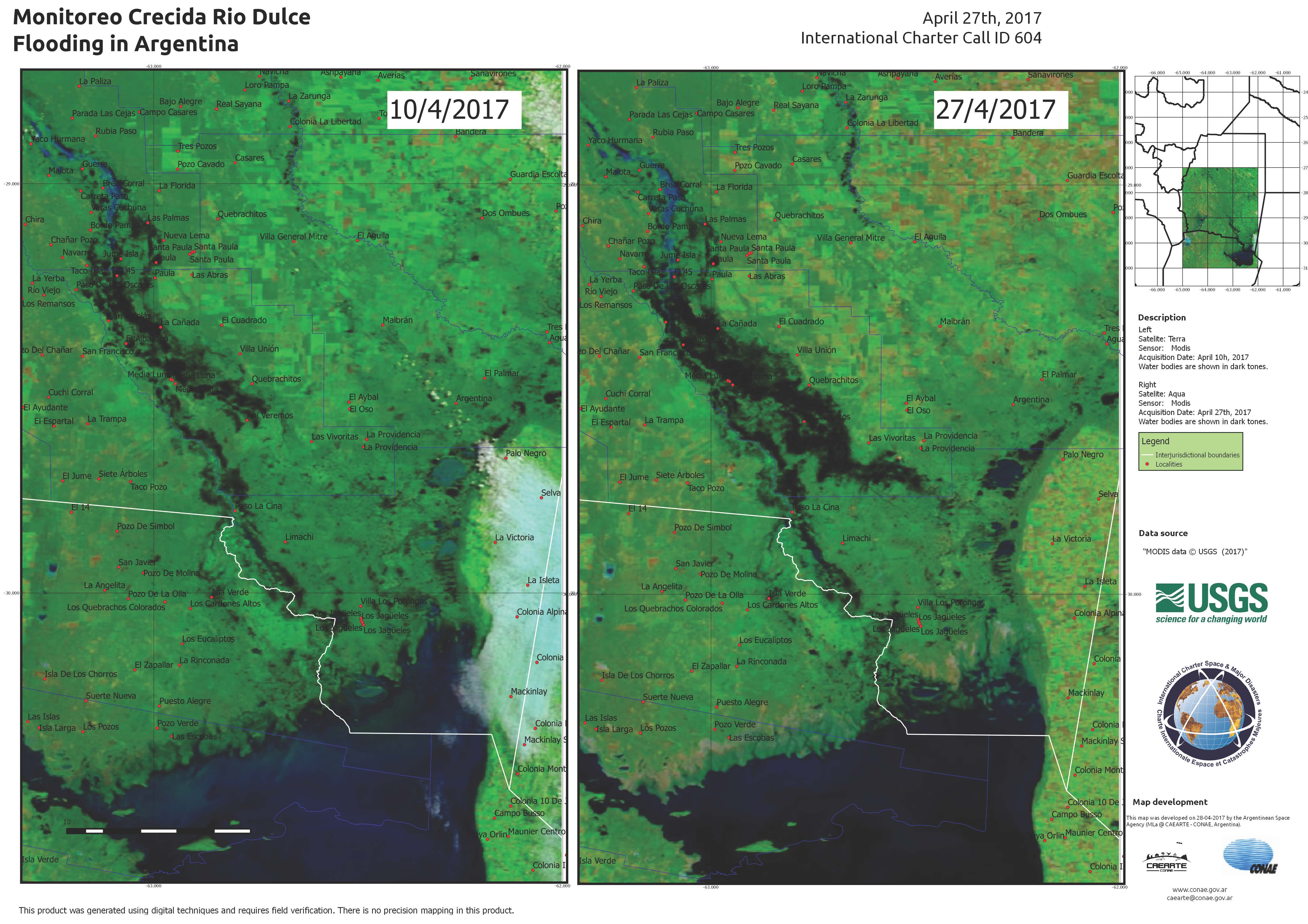
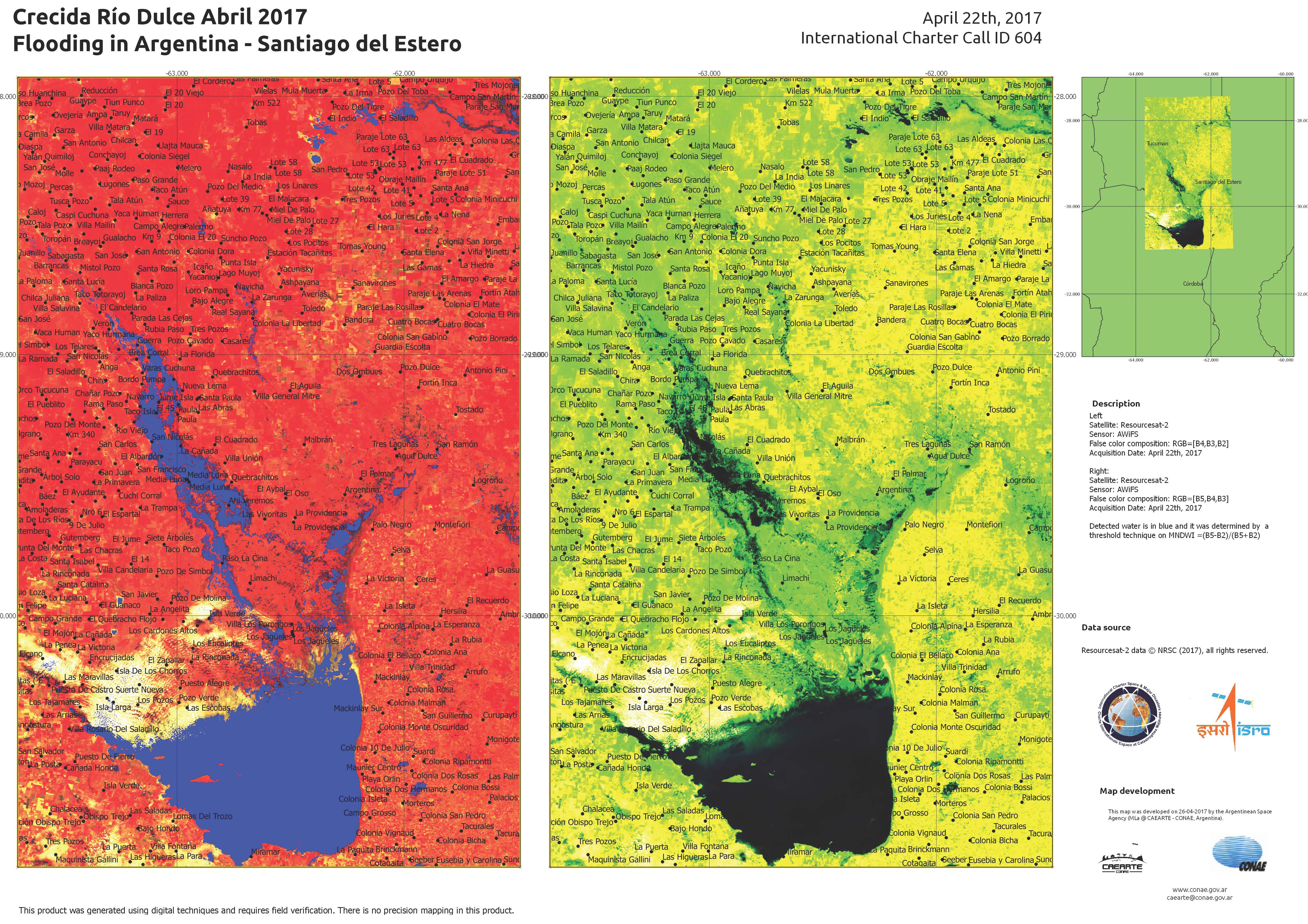
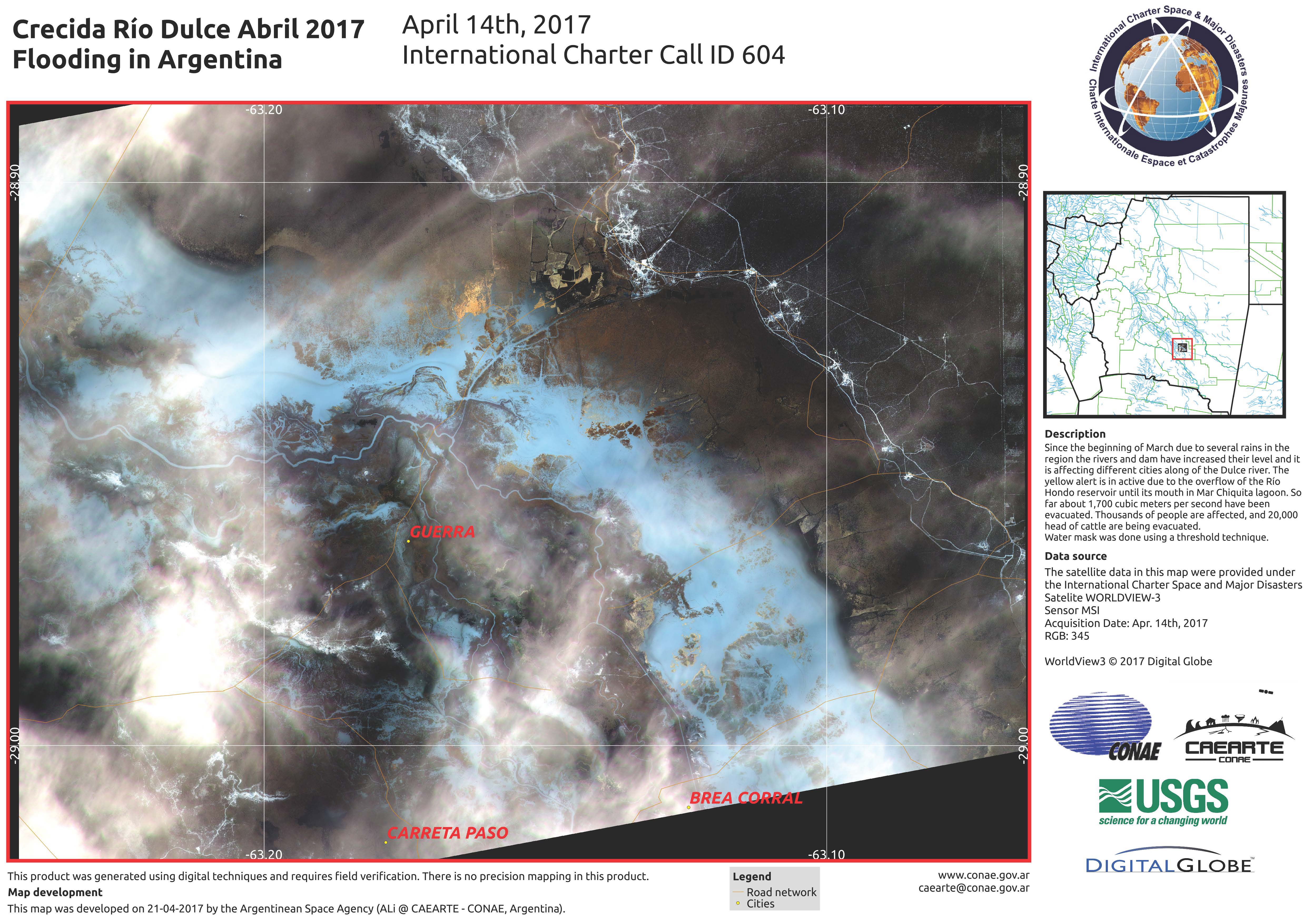
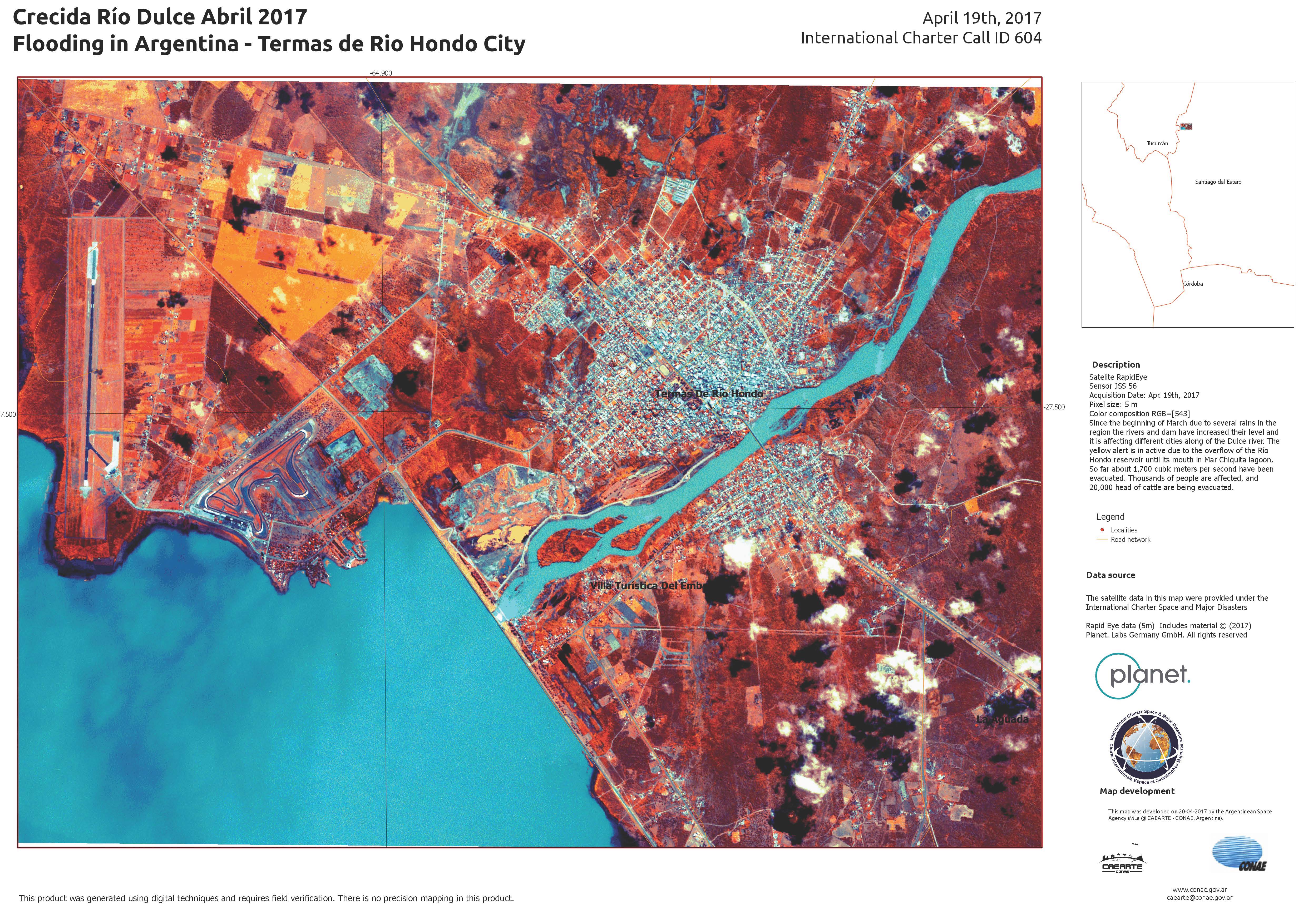
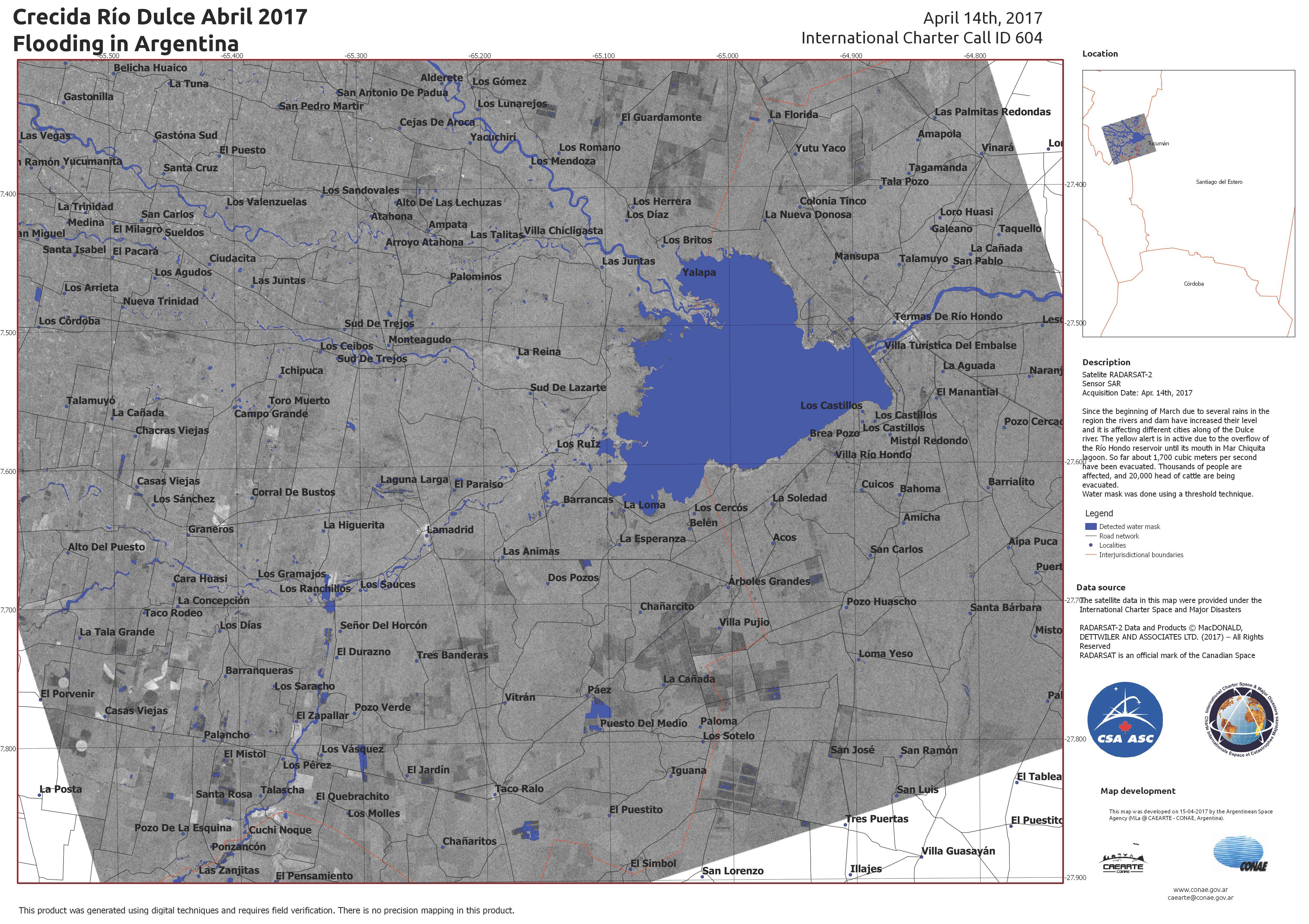
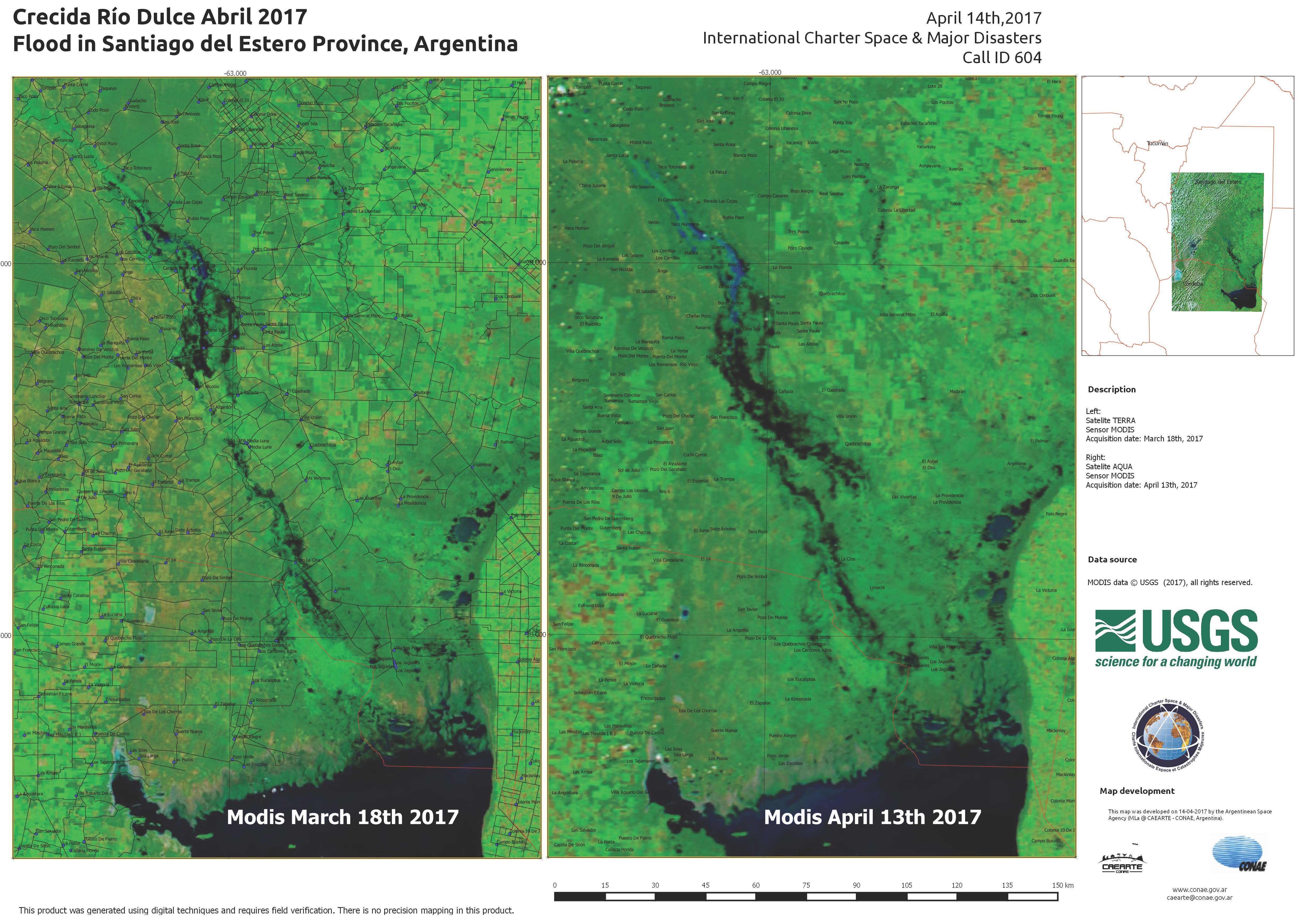
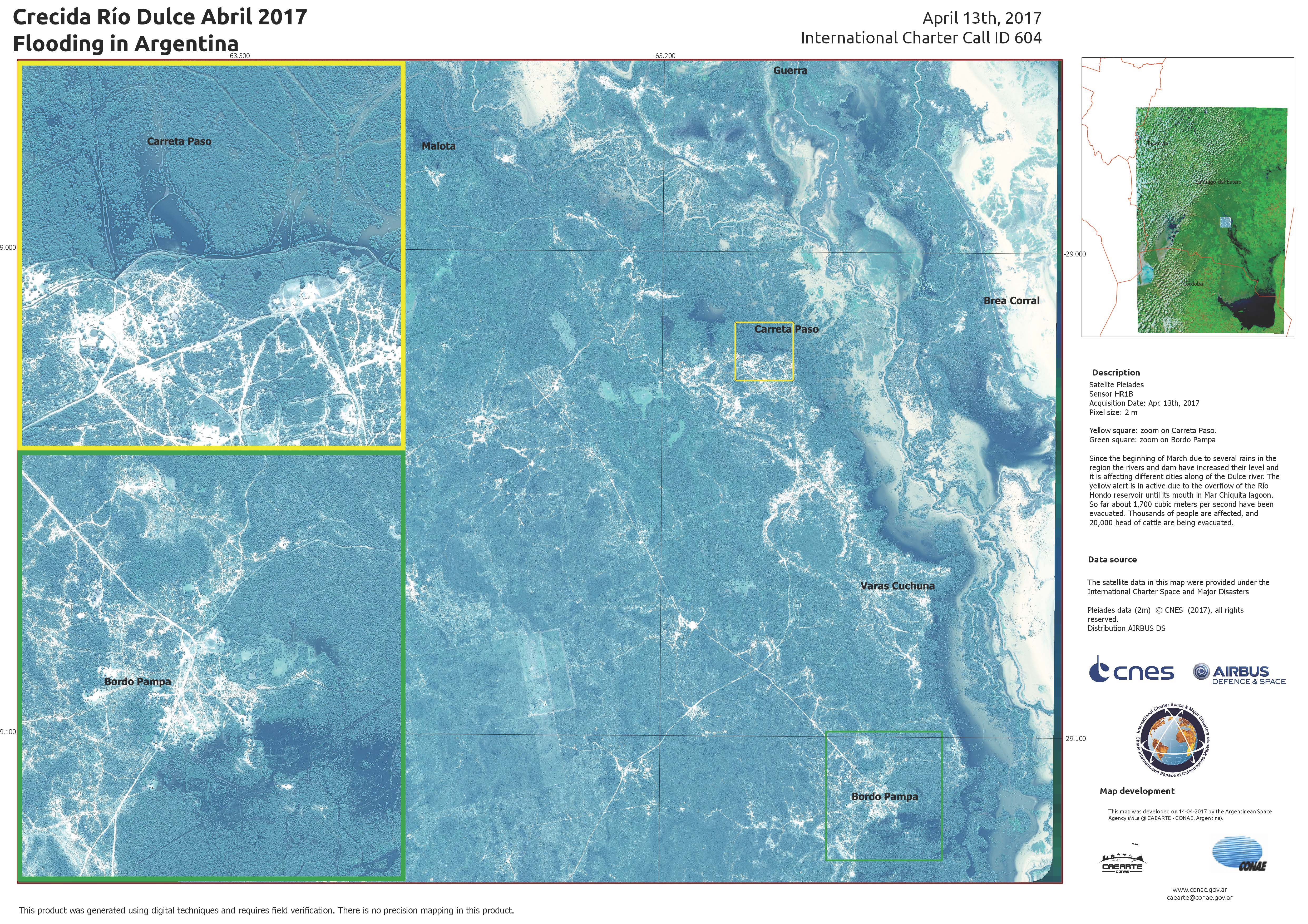
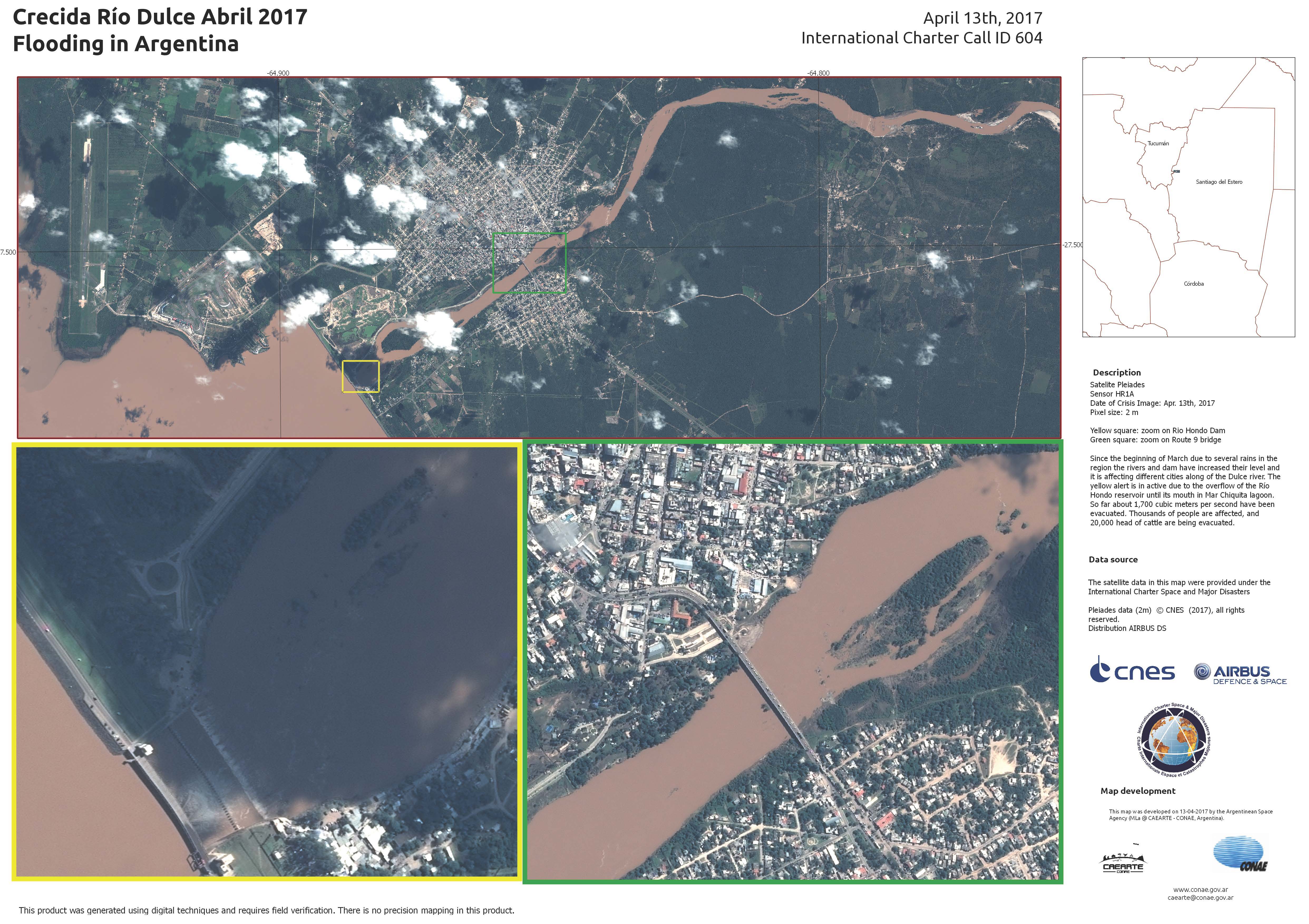
Flood in Argentina
Torrential rain has caused flooding in Argentina, forcing thousands of people to evacuate.
The rain started at the end of March and has caused the Dulce and Chico Rivers to overflow, affecting cities in the area.
One city which has particularly been affected is Rivadavia. Estimates suggest that 80% of the city has been destroyed by floods and mudslides after the city received more than a year of rain in less than a week. Bridges and roads in the city were destroyed or disrupted and much of the city is flooded with mud and water.
A yellow alert is also in place for the Río Hondo reservoir, located in northern Argentina, which is overflowing.
| Type of Event: | Flood |
| Location of Event: | Argentina |
| Date of Charter Activation: | 12 April 2017 |
| Time of Charter Activation: | 19:30:00 |
| Time zone of Charter Activation: | UTC+02:00 |
| Charter Requestor: | Secretaria Nacional de Protección Civil de Argentina – Min. de Seguridad SIFEM Argentina |
| Activation ID: | 525 |
| Project Management: | CONAE |
Products
Flooding on the Dulce River, Argentina
Copyright: RADARSAT-2 Data and Products © MacDonald, Dettwiler and Associates Ltd. (2016) - All Rights Reserved. RADARSAT is an official trademark of the Canadian Space Agency.
Map produced by CONAE
Information about the Product
Acquired: 18/04/2017
Source: RADARSAT-2

 Back to the full activation archive

