 English
 Spanish
 French
 Chinese
 Russian
 Portuguese
 Latest Activation
Charter activations
Flood in India
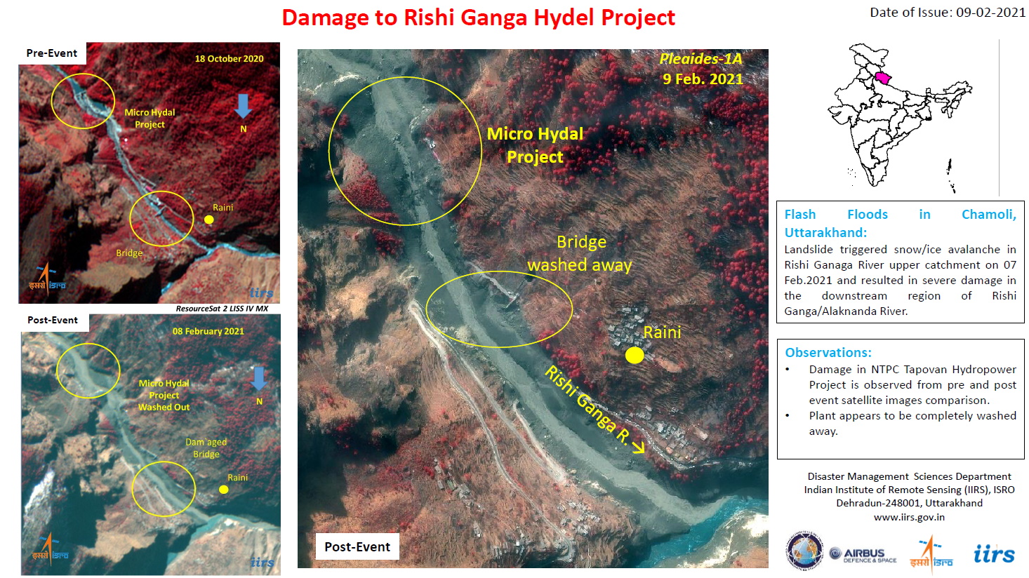
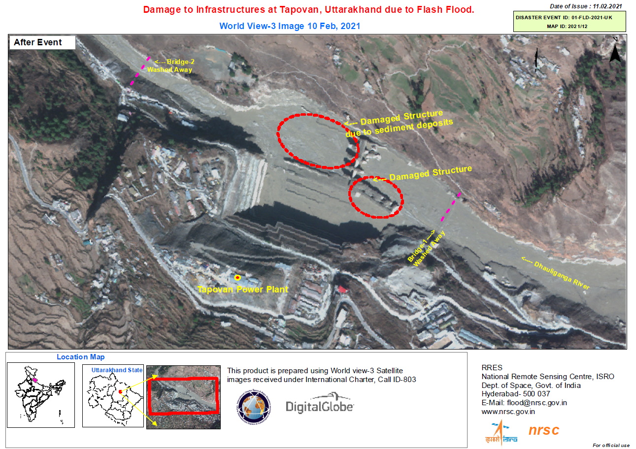
Part of Nanda Devi glacier broke off in Uttarakhand's Chamoli district on 7 February, triggering an avalance that struck the Rishiganga Hydroeletric Dam. The collision at the dam and influx of water caused a surge of flood water along the Dhauliganga river.
Dozens of villages along the river have been evacuated, and rescue operations are underway to free people trapped at the dam or elsewhere in the flood's path, but more than a hundred people have been confirmed lost with their current status unknown.
| Type of Event: | Flood |
| Location of Event: | India |
| Date of Charter Activation: | 2021-02-07 |
| Time of Charter Activation: | 15:02 |
| Time zone of Charter Activation: | UTC+05:30 |
| Charter Requestor: | ISRO |
| Activation ID: | 698 |
| Project Management: | IIRS |
Products
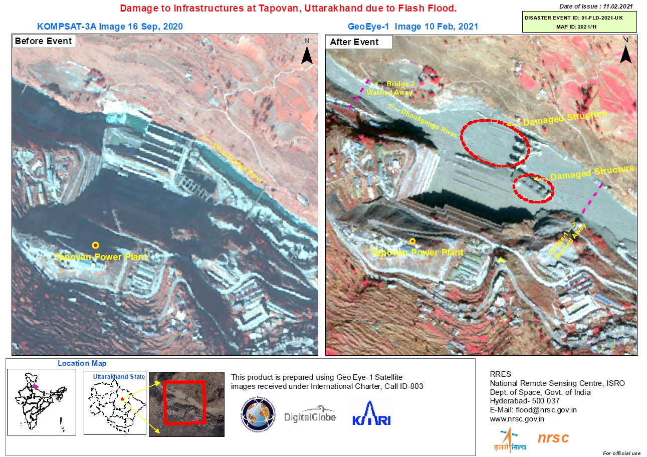
Damage to Tapovan Dam location site
Copyright: © (2021) DigitalGlobe, Inc., Longmont CO USA 80503. DigitalGlobe and the DigitalGlobe logos are trademarks of DigitalGlobe, Inc. The use and/or dissemination of this data and/or of any product in any way derived there from are restricted. Unauthorized use and/or dissemination is prohibited
Map produced by NRSC / ISRO
Information about the Product
Acquired: WorldView-3: 10/02/2021
Source: WorldView-3


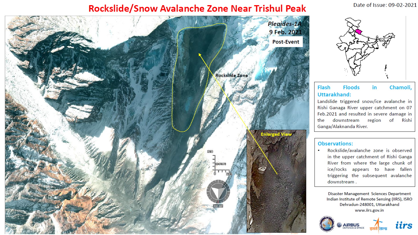

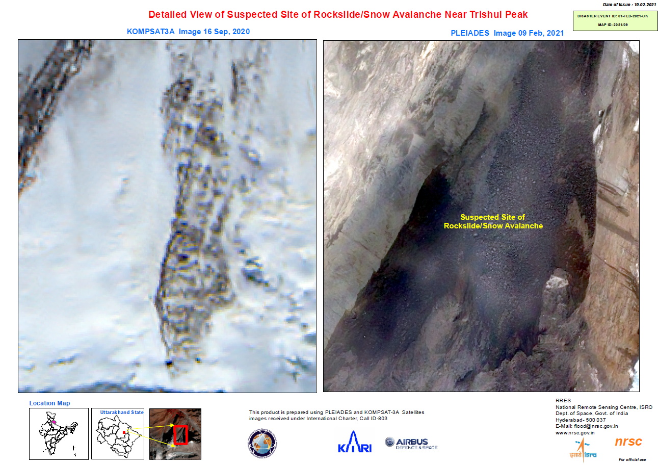

Study of suspected rockslide / avalanche near Trishul Peak, Uttarakhand
Copyright: Contains modified Copernicus Sentinel data (2021)
© KARI (2020).
Includes Pleiades material © CNES (2021), Distribution Airbus DS.
Map produced by ISRO / NRSC
Information about the Product
Acquired: KOMPSAT-3: 16/09/2020
Sentinel-2: 05/02/2021
Pleiades: 09/02/2021
Source: Sentinel-2 / KOMPSAT-3 / Pleiades
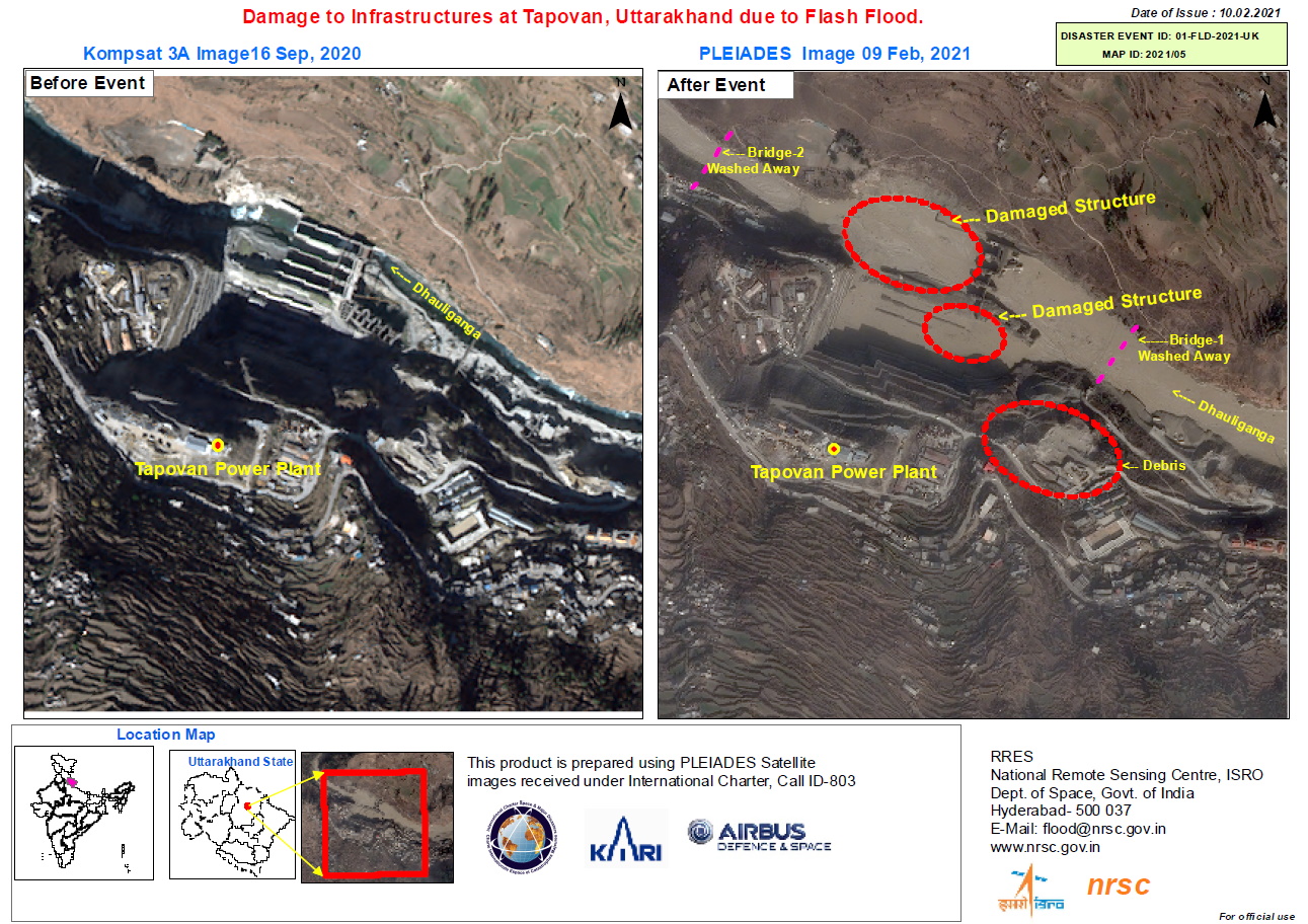
Damages to Infrastructure in Tapovan, Uttarakhand flash floods
Copyright: Includes Pleiades material © CNES (2021), Distribution Airbus DS.
KOMPSAT-3 © KARI (2020).
Map produced by ISRO / NRSC
Information about the Product
Acquired: Pleiades: 09/02/2021
KOMPSAT-3: 16/09/2020
Source: Pleiades / KOMPSAT-3


 Back to the full activation archive

